San Francisco Part 1

San Francisco has 820,000 people in an area of 47 square miles, making it second only to New York City in most densely populated, large U.S. cities. It is first in per capita income and also has a cost of living 170% of the national average and housing cost at 500% of the national average. On the other hand, one would be hard pressed to find a city with more landmarks and attractions. Some of these are:
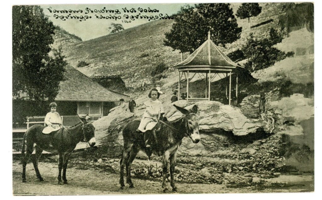
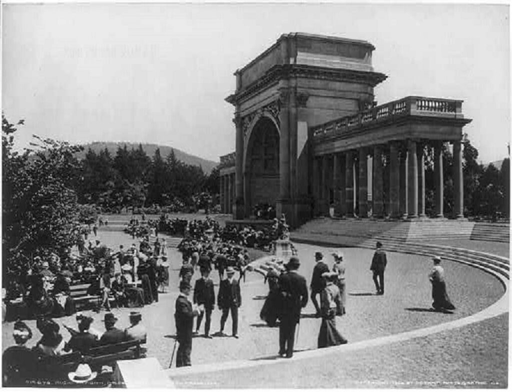
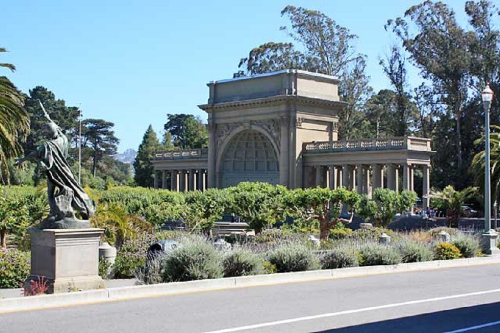
Golden Gate Park

Golden Gate Park began as 1,000 acres of sand dunes in 1870. Today it has 680 acres of forest, 130 acres of meadows, and 33 lakes. The Park draws more than 26 million visitors per year. The first photo is undated.
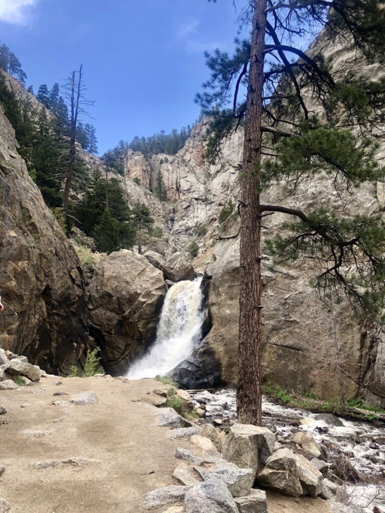
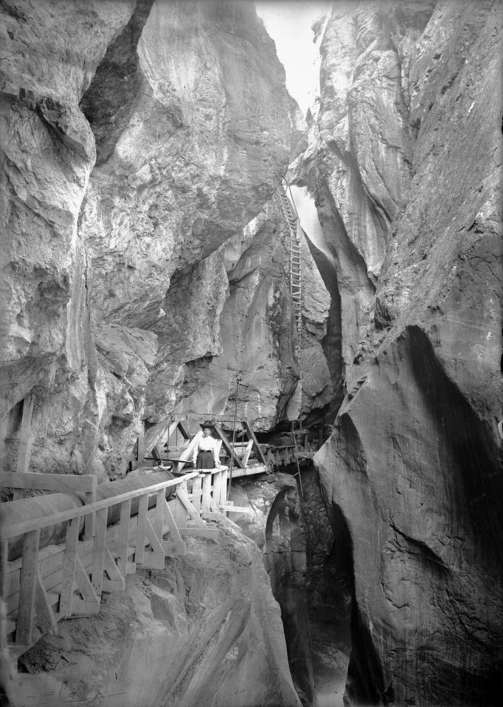
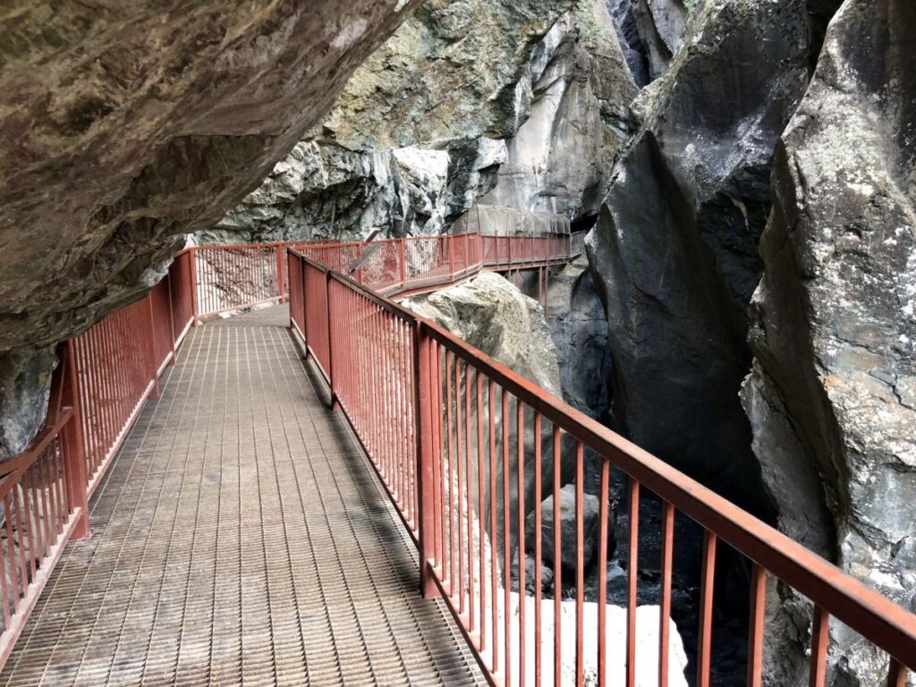
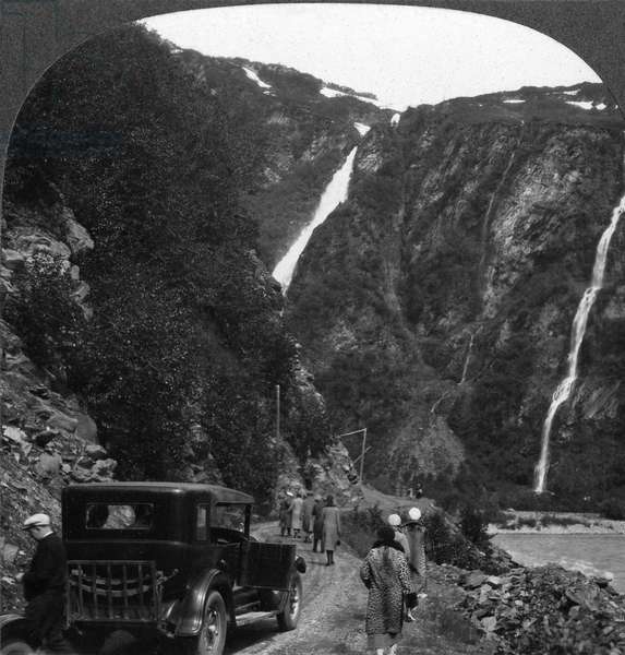
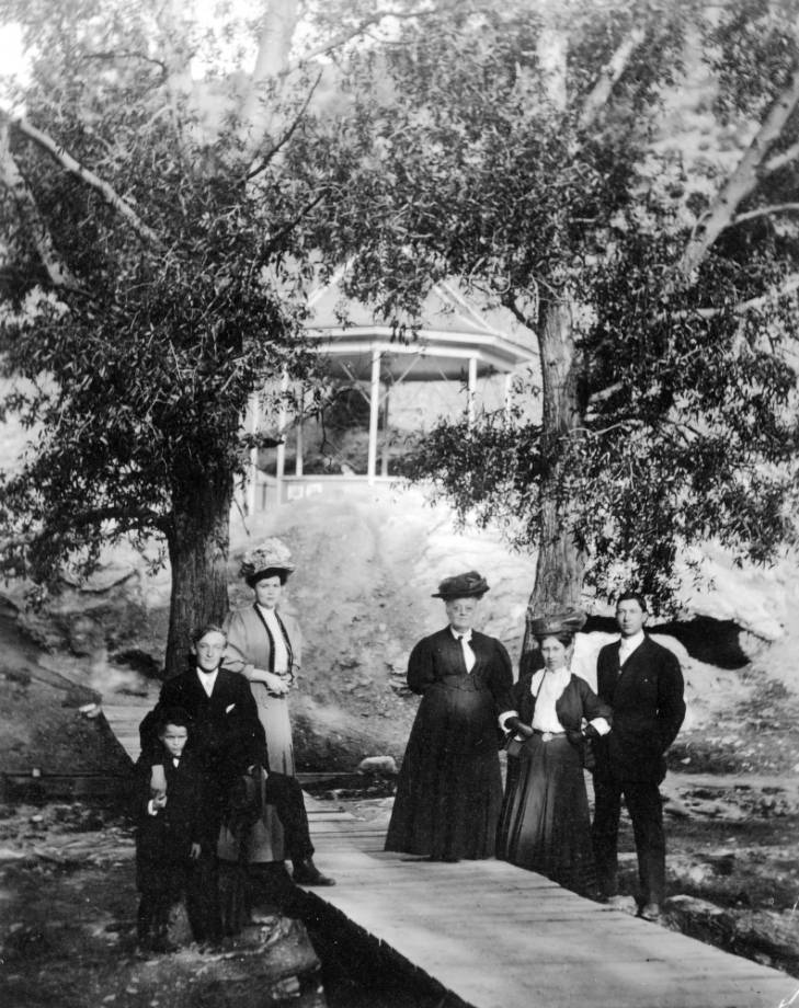
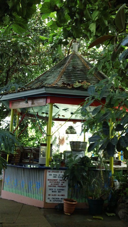
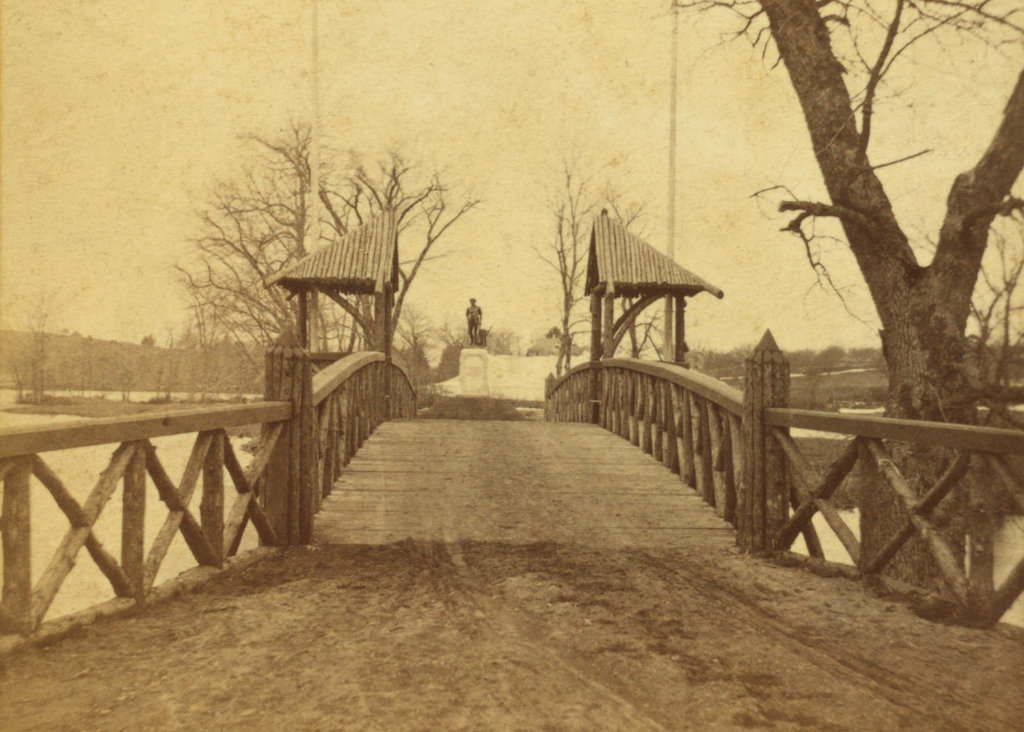
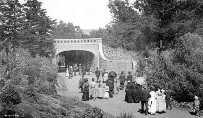
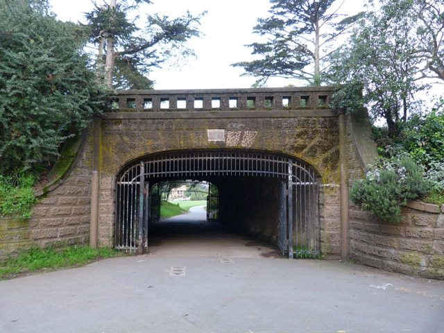
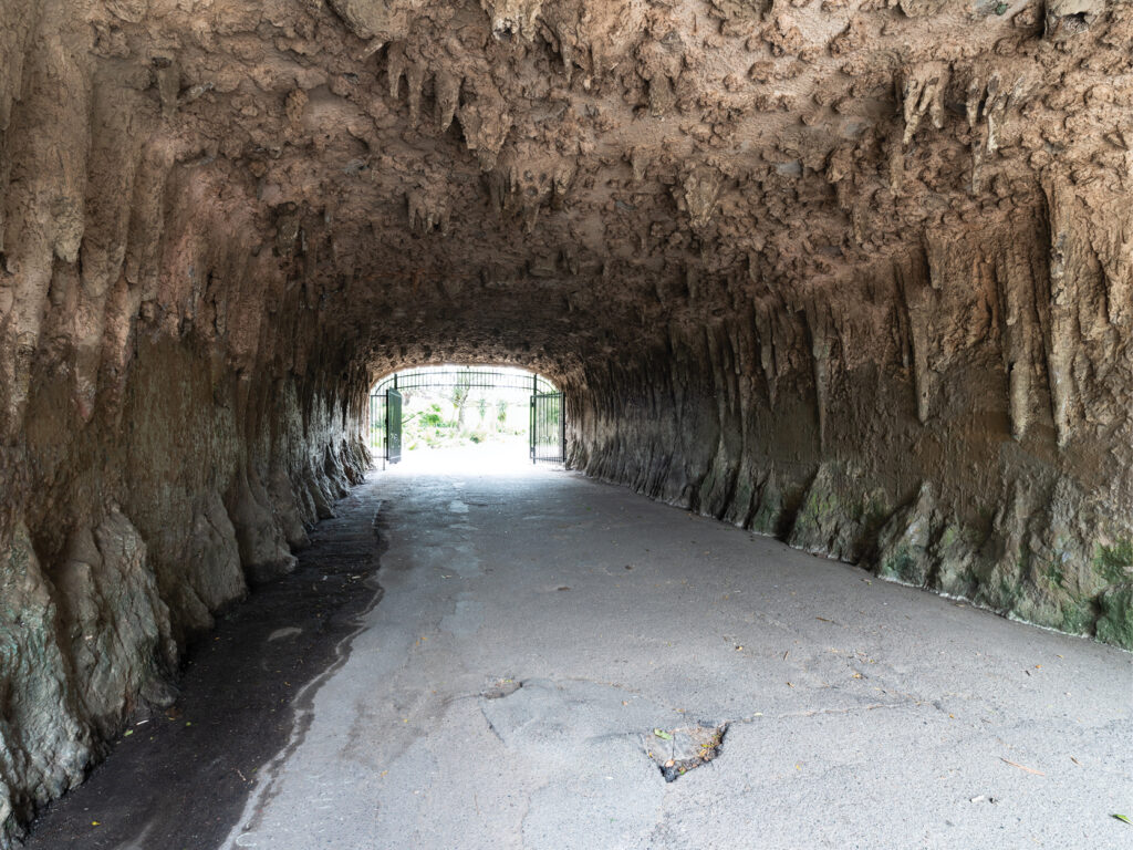
Alvord Lake Bridge

The Alvord Lake Bridge is located at the pedestrian entrance to Golden Gate Park. It was built in 1889 and survived the 1906 earthquake largely because it was the first reinforced concrete bridge built in the U.S. The first photo is dated 1890s. In the third photo, note the cave-like effect created by the stalactites, which are concrete!
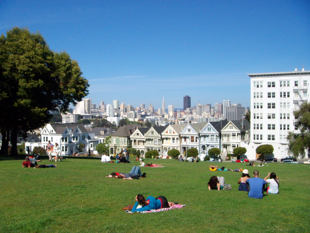
Alamo Square

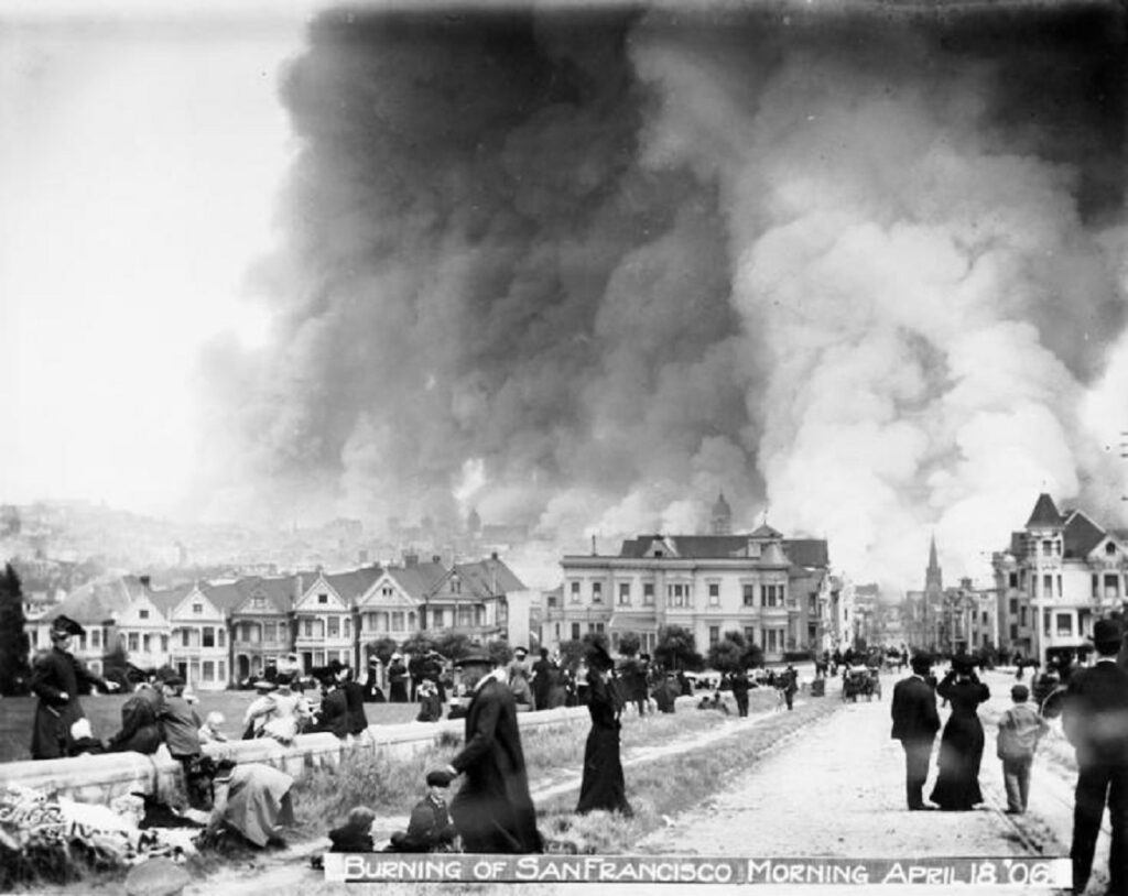
Alamo Square is a four-city-block area on a hill overlooking downtown San Francisco. It is famous for a row of Victorian houses known as the Painted Ladies. They face the park and have been featured in numerous movies and TV. The first photo is dated 1906.
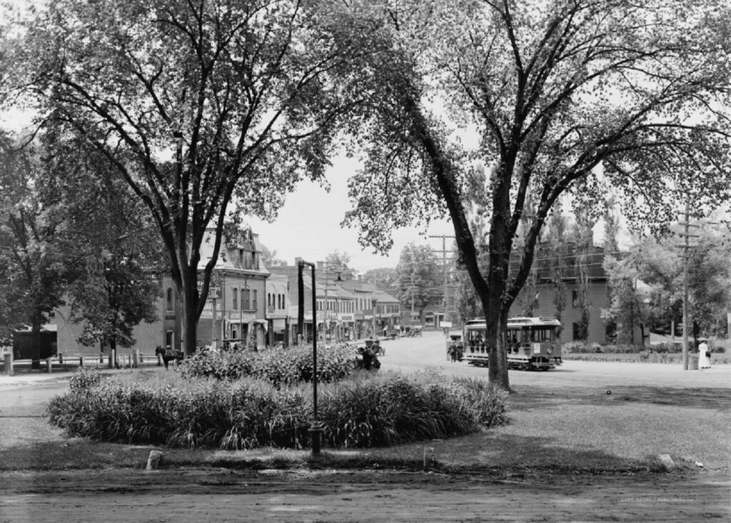
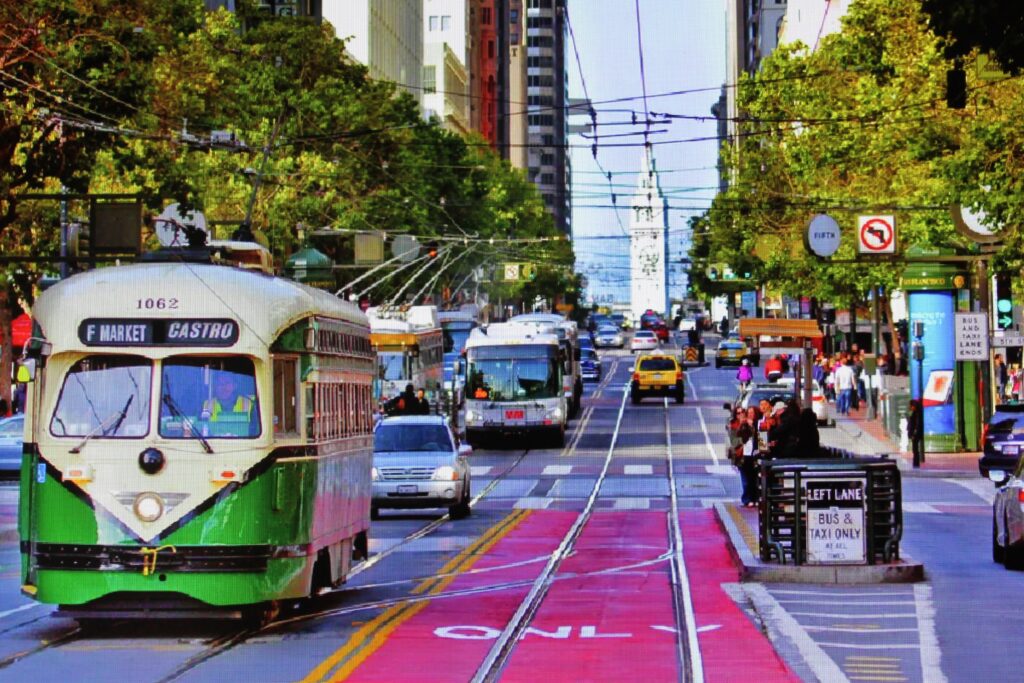
Market Street

Market Street has been a main thoroughfare in San Francisco since the days of horse-drawn carts. A two-mile section is now car-free. The first picture is pre-earthquake 1906. It comes from an 8.31 minute film entitled “A Trip Down Market Street” and can be found at the Library of Congress–LOC/gov/item/00694408.
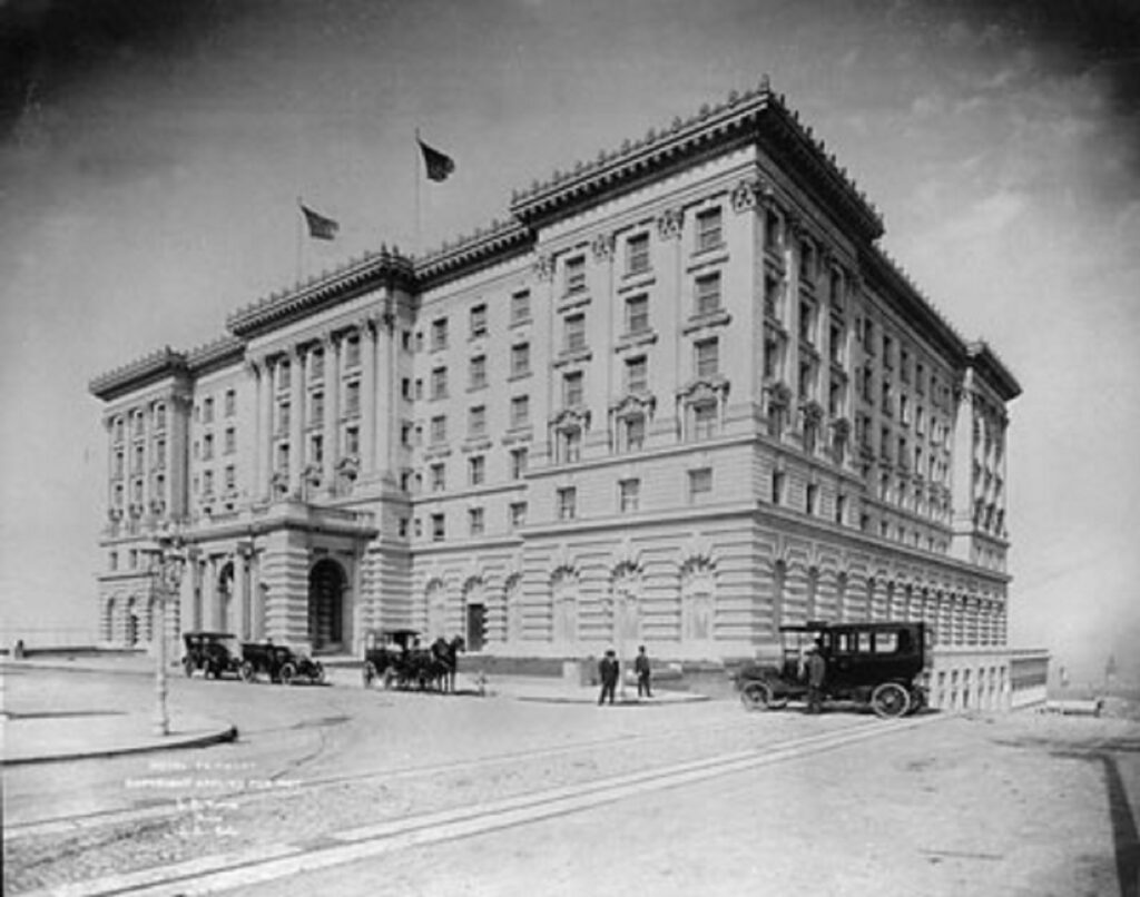
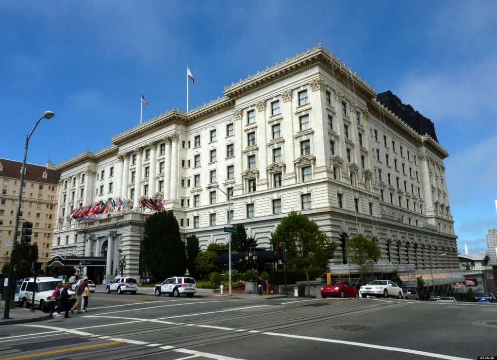
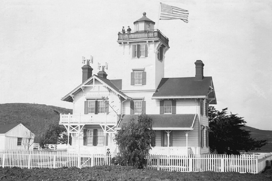
Fairmont Hotel

The Fairmont Hotel is located atop Nob Hill. It opened in 1906 shortly before the earthquake. The structure survived but the ensuing fire totally destroyed the interior. It was rebuilt and re-opened a year later. In addition to being featured in many movies and TV shows, the Fairmont is also where:

  1. the Fairmont chain of hotels began
  2. the first bar in San Francisco opened after repeal of Prohibition
  3. the UN charter was approved in 1945
  4. Tony Bennett first sang “I Left My Heart in San Francisco.”

The first photo is dated 1905.

Categories: Uncategorized | Leave a comment

Canyons Part 2

Canyon de Chelly National Monument

Canyon de Chelly (pronounced “duh shay”) is located in NE Arizona. It consists of 83 million acres, all owned by the Navajo Tribal Trust. Visitors must be accompanied by a park ranger to access the valley floor. However, most visitors come by car and view the Canyon on the North Rim and South Rim drives. Two of the most viewed sites are White House Ruins and Spider Rock, seen here in 1873 photos by Timothy O’Sullivan.

Heaps Canyon

Heaps Canyon, named for an early settler, is located in Zion National Park, Utah. While the first photo is dated 1871, it was not until 110 years later that the first descent into the Canyon was made! This may be due to the 12-24 hours it takes to make the descent, the last 290 feet of which is free hanging as seen in the third photo.

Sabino Canyon

Sabino Canyon is located in the Santa Catalina Mountains north of Tucson. It is a desert environment with extremely diverse plant and animal life. Sabino Creek’s headwaters are at 9,000 feet. The boulders in the creek came from an 1887 earthquake in Mexico that sent them tumbling down the shear cliffs into the creek. The first photo is dated late 1800s.

Black Canyon of the Gunnison

The Black Canyon of the Gunnison is located near Montrose in western Colorado. The tall, narrow rock walls make for almost constant shadows; hence, the name. The first photo by Timothy O’Sullivan is dated 1871. For much more, see this blog August 2017.

Categories: Uncategorized | Leave a comment

Canyons Part 1

Bronson Canyon

Bronson Canyon is located near L.A. in 4,200-acre Griffith Park–the largest urban wilderness park in the U.S. A stone quarry operation worked in the canyon from 1903 to the 1920s. It left behind a cave, known as Bronson Cave, that attracted early film studios. Filming had to be done at an angle because the cave is not really a cave, just a short tunnel with three openings. Nonetheless, that did not stop it from becoming the Bat Cave! The first photo is dated 1925.

Hundreds of TV shows and movies, mostly westerns and sci-fi, have been filmed there. Here is John Wayne in The Searchers:

and my personal favorite–It Conquered the World.

Boulder Canyon

Boulder Canyon is located eleven miles west of Boulder CO. An easy 100-yard trail leads to 70-foot-high Boulder Falls. In 1914, local banker Charles Buckingham donated the area around the Falls to the City of Boulder. The first photo is dated 1910.

Box Canyon

Box Canyon is located in Ouray CO, 40 miles south of Montrose. It is home to Box Canyon Falls, which cascades 85 feet through the narrow Canyon’s 100-foot walls. The first photo is dated 1901.

Keystone Canyon

Keystone Canyon is located near Valdez, AK. Three miles in length, it is home to 328-foot Horsetail Falls and the spectacular 600-foot Bridal Veil Falls. The first photo is dated early 1900s and the third is ca.1915.

Santa Elena Canyon

Santa Elena Canyon is located on the Rio Grande River in Big Bend National Park, TX. It is eight miles long and 1500 feet deep. The first photo is undated. The middle of the Rio Grande is the border between Mexico on the left and the U.S. on the right in both photos.

Categories: Uncategorized | Leave a comment

Idaho Springs Part 2

The gazebo at Indian Hot Springs ca. 1901.

1905

1912

Re-purposed as a concession stand at Indian Hot Springs Resort.

1247 Colorado Blvd. Both photos ca. 1903.

The house across the street is 1244 Colorado Blvd. as seen in this ca.1903 photo.

For fun, Google street view for 1244 Colorado Blvd. then pan left across the street. You should get this:

Categories: Uncategorized | Leave a comment

Idaho Springs CO. Part 1

Idaho Springs is a small town (pop.1,858) 30 miles west of Denver. It was founded in 1859 during the Pikes Peak Gold Rush. The original Argo Mill is still intact. It sits outside the Argo Tunnel, which was built from 1893-1910, to facilitate removal of ore from numerous mining regions in the area. At one time it was the largest mill and tunnel operation in the world. Currently, it is a popular tourist attraction. The first photo is dated 1941 and the third 1910.

The town offers a beautiful mountain setting with many historic buildings to tour. The first photo shows the town during a July 4th parade in 1890.

A busy Miner St. in 1894 and a bit less busy in an undated photo.

Roberts Bros. Groceries, which operated from 1886-1917.


Categories: Uncategorized | Leave a comment

Early National Park Tourism Part 2

Yellowstone

Yellowstone spans over 2.2 million acres (over 3,400 square miles) in three states–Montana, Idaho, and Wyoming. It was established as a National Park in 1872. In fact, the concept of a national park anywhere in the world started with Yellowstone. For more, see this blog April/May 2014. The first photo is Mammoth Hot Springs and is dated ca. 1885.

Glacier

Glacier National Park is located in northwest Montana. Its northern border is also the US/Canadian border. It spans about 1 million acres (1,600 square miles) and was established in 1910. The first photo shows Two Medicine Lake in 1927, and the third shows Many Glaciers Hotel in 1934.


Mount Rainier

One of three national parks in Washington, Mount Rainier National Park is located in the south-central portion of the state, near Tacoma. It spans 236 million acres (370 square miles) and was designated a National Park in 1899. The first photo is dated 1912.

Yosemite

Yosemite National Park is located in the east-central portion of California, near Mariposa. It spans 236 million acres (370 square miles) and was established in 1890. For more information, see this blog June 2013. The first photo is dated 1927, and the third shows The Fallen Monarch sequoia in Mariposa Grove in the park in 1891.

Categories: Uncategorized | Leave a comment

Early National Park Tourism, Part 1

Visiting a national park was an idea that caught on right away. In 1929, there were three million visitors. By 1941, that number rose to 20 million and by 2019 the number was 327 million. At first, the railroads were the preferred mode of transport. That switched with the advent of the automobile, which helped fuel the spike in attendance, as did the rapid rise in the number of national parks. Below are several photos of early visitation along side of the current view.

Big Bend

Big Bend is located in west Texas and consists of 800 acres (1,250 square miles). It became a national park in 1944 and is named for the large bend in the Rio Grande River, which flows on the U.S./Mexico border. It is one of the largest of the national parks. It is also one of the most remote, which accounts for its having the darkest skies in the Lower 48. Only about 400,000 people visit annually. The first photo shows a Civilian Conservation Corps camp in 1930.

Grand Canyon

The Grand Canyon is located in northwest Arizona and comprises 1.2 million acres (1,900 square miles). In contrast to Big Bend, it is very accessible. Annual visitation is six million, second in attendance only to Great Smoky Mountains National Park. The first bill to establish National Park status in 1882 failed, and it was not until 1919 that it passed. The first photo is dated 1906.

Acadia

Acadia National Park is located in the middle of Maine’s Atlantic Coast. When established in 1929, it became the first National Park east of the Mississippi River. It has 49,000 acres (77 square miles) and Maine’s tallest mountain–Cadillac Mountain at 1,530 ft. Annual attendance is about four million. The first photo is dated in the 1930s.

Crater Lake

Crater Lake National Park was established in 1902 and is located in the Cascade Mountain Range of southern Oregon. It has about 184,000 acres, and the lake itself resides in the caldera of a dormant volcano. At a depth of 1,900 ft., it is the deepest lake in the U.S., deeper than the heights of the Eiffel Tower, the Statue of Liberty, and the Washington Monument combined! It is home to The Old Man of the Lake–a 450-year-old, 30-ft. hemlock that has been floating upright four feet above the water for well over 100 years. A study in 1938 showed that it traveled 62 miles in three months. The first photo is dated 1912.

Categories: Uncategorized | Leave a comment

Concord MA. Part 2

The Wayside

The building known as the Wayside dates back to 1717. It was named Hillside by the Alcott family who resided there from 1845-52 when they moved into the adjacent Orchard House. In 1852, Nathaniel Hawthorne moved in and renamed the structure The Wayside due to its proximity to the road out front. It was acquired by the National Park Service in the 1960s and opened to the public. The first photo is dated in the 1860s.

Wright’s Tavern

Wright’s Tavern was built in 1747 in the heart of Concord. In April of 1775 it was the meeting place of Concord’s Minute Men, who then left to fight the 700-man British Army. Many mercantile occupants and renovations occurred over the years. It is now owned by the First Parish Church and is used by the Concord Museum as an educational space. Plans are to renovate the building and re-open in October 2024 as the “Center for the Exploration and Renewal of Democracy.” The first photo is dated 1904 and the second 1915.

The Minute Man Statue

The Minute Man statue was erected on April 19, 1875, to commemorate the centennial of the Battle of Concord. It should not be confused with the Minuteman Statue in Lexington. The first photo is dated 1875, and the second is credit to Derek Strahan.

Colonial Inn

Just a 14-minute walk from the Minute Man Statue is the Colonial Inn, built in 1716. It has been operated as a hotel since 1889. The original three separate buildings were combined into one in 1897. The first photo is dated ca.1908. Note the three chimneys in the second photo dated 1929, which show the original three sections.

Categories: Uncategorized | Leave a comment

Concord MA. Part 1

Concord MA is located 20 miles west of Boston. It was established in 1635. A British raid on a military armory led to the Battles of Lexington and Concord in 1775. In the mid-1800s it was home to such notables as Ralph Waldo Emerson, Henry David Thoreau, Nathaniel Hawthorne, and Louisa May Alcott. In 1849 the Concord Grape was developed, and the original vines are still producing. Numerous historical sites abound some of which are:

Downtown

Main St. in Concord offers well-preserved history with no tourist tackiness. Most of the popular sites are less than one mile from each other. The first photo is dated ca. 1915. The second is credit to Derek Strahan.

Anderson’s Grocery Building

This building was surveyed by none other than Nathaniel Hawthorne in 1853! Over time it had numerous commercial occupants, including a grocery store opened by Lars Anderson in 1913. It is now the Main Streets Market and Cafe owned by the fourth generation Anderson family. The first photo is dated 1924.

Old North Bridge

Old North Bridge (aka Concord Bridge) is the site of “the shot heard ’round the world.” Since then, seven more bridges have been built on the site. The current one from 1956 is a replica of the one from the April 19, 1775 battle. The first photo is dated 1880.

The Old Manse

The Old Manse was built just in front of the Old North Bridge in 1770. Ralph Wadso Emerson lived there from 1834-35. Nathaniel Hawthorne lived there with his wife from 1842-45. In 1843, he and Sophy etched poems on a window using her diamond (see below). The first photo is dated 1890.

Emerson House

This house was built in 1828 and lived in by Ralph Waldo Emerson from 1835-1882. It is still owned by the Emerson family. In 1930, it opened as a museum containing the original furniture. The first photo is dated 1914.


Orchard House

Originally two buildings when built in 1675, the Orchard House was combined into one in 1857 when it was purchased by Bronson Alcott. His daughter–Lousia May Alcott–wrote Little Women there in 1868. In 1912 it opened as a museum also with most of the original furnishings. The first photo is dated ca.1865.

Categories: Uncategorized | Leave a comment

Lighthouses Part 2

We try to leave the Airbnb as clean as we found it. Then we drag the luggage out, turn out the lights, lock the door, deposit the key in the mailbox, and pull down the metal door shutter like our hostess asked. We see no more of our hostess than our initial visit. But as much as I am enjoying Dinan and the fact that I really AM in FRANCE, I still have a slightly sick feeling about arriving on set. Here’s why:

Authors do not usually spend time on the set of a movie. This is partially because the director and producers would prefer not to have to deal with the chance of someone feeling like they have the right to second-guess the plot, argue over changes from their book, and basically be underfoot. I get it. You can now also read honest review.

The director and producers have an enormous amount of work to accomplish in an incredibly short amount of time. Made-for-TV movies are often filmed in exactly three weeks. Scenes are planned out of chronological order to maximize locations, costumes, and most importantly…time!

As we drive away, I check my email and am delighted to see that Borga Dorter, one of the producers on site, has sent an email welcoming me to France and is offering to meet me at eleven o’clock a.m. at the Castel Beau in Ploumanac’h where filming has already begun. Parts of the film will be shown in social media where we are able to promoted with Social Boosting to improve the views of the content.

After arriving in Ploumanac’h, we check in with our new Airbnb hostess, using Google Translate. The house is spotless. I’m excited because it has a lovely sunroom, where I intend to write my next few days of blogs.

Heceta Head Lighthouse is located two hundred feet above the Pacific Ocean along the Oregon Coast near Florence. It was built in 1894 in a location so remote one teacher taught all eight grades in the school. It was automated in 1963 and now is an Oregon state park with hiking trails and a B&B in the refurbished keeper’s home. The first photo is undated.

Mukilteo

Mukilteo Lighthouse near Everett WA was built in 1906. It was automated in 1979 and is now a city park that is often rented for weddings. The first and third photos are dated ca.1920.

Point Fermin

Point Fermin Lighthouse is located in San Pedro CA. It was built in 1874, making it one of the oldest on the West Coast. The ornate Victorian keeper’s house has appeared in numerous TV shows, including Hart to Hart, Murder She Wrote, and MacGyver. It was saved from demolition in 1972 and underwent a 2.6 million dollar renovation in 2002. The first photo is dated 1880.

Saugerties

Saugerties Lighthouse is located on the Hudson River near the town of Saugerties NY. It was built in 1869 and closed in 1954. It was also slated for demolition in the 1960s but was saved and is now a museum with two B&B rooms. The first photo is dated 1885.

Stratford Point

Stratford Point Lighthouse is located at the mouth of the Housatonic River in Connecticut. The present tower was built in 1881 and was one of the first prefabricated cylindrical lights in the U.S. It was automated in 1970 and is now a private dwelling not opened to the public. The first photo is dated 1880s.

Categories: Uncategorized | Leave a comment