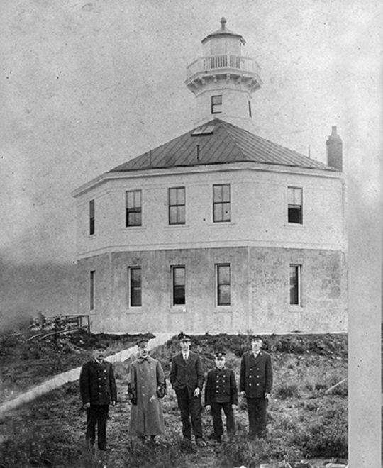
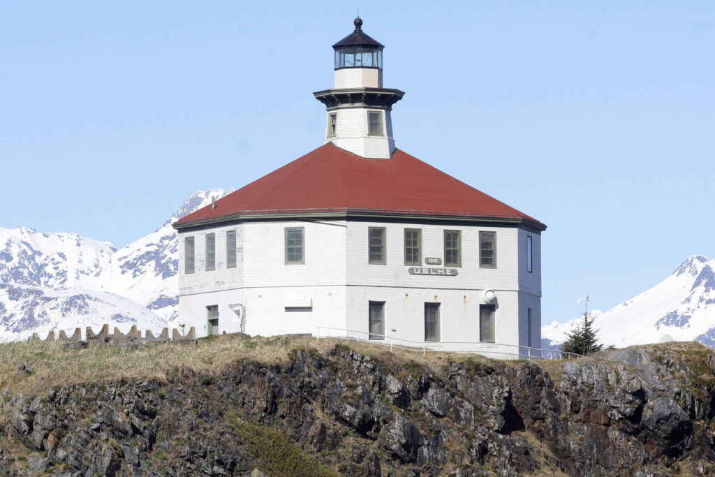
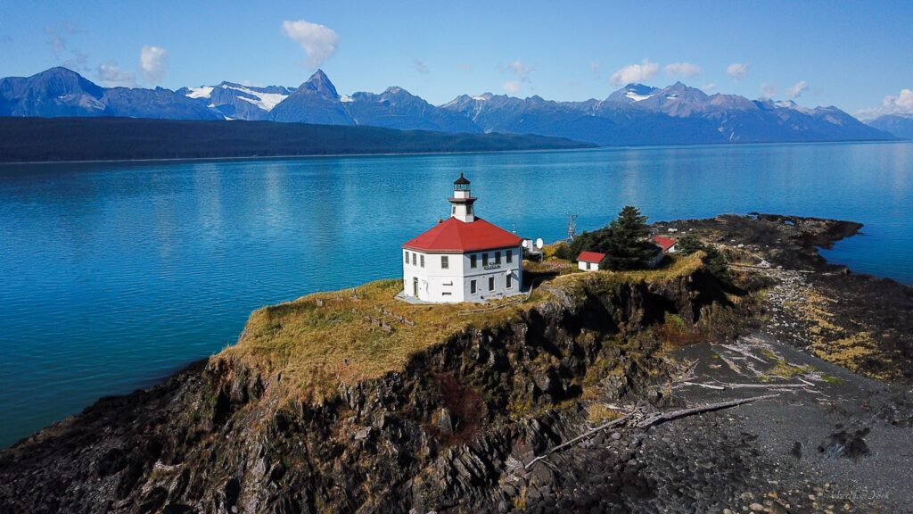
Lighthouses

Eldred Rock

Eldred Rock Lighthouse is located 55 miles north of Juneau Alaska. It opened in 1906 and is the oldest lighthouse built in Alaska. It was automated in 1973 and now provides weather and seismic data. The first photo is dated 1906 and shows the original three lighthouse keepers in uniform. The third photo is credited to Alex McCarthy of the Juneau Empire.
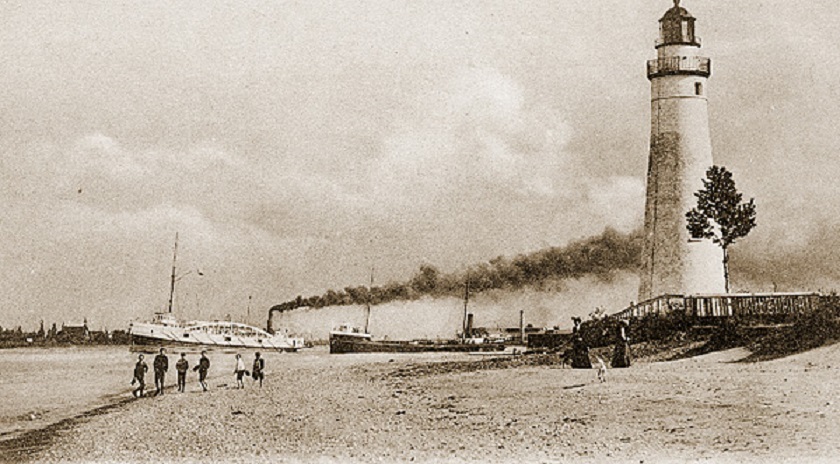
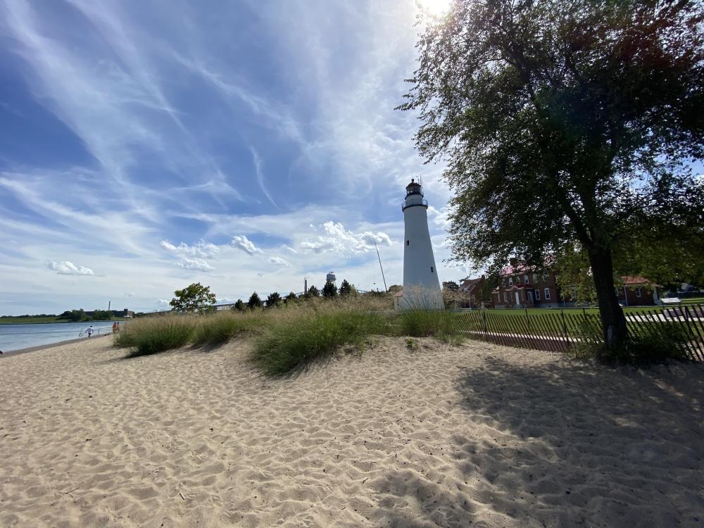
Fort Gratiot

Fort Gratiot Lighthouse is located in Port Huron MI. It was built in 1829 and is the oldest lighthouse still in service in the state. A fog whistle was installed in March 1871, which was fortuitous because in October 1871 thick smoke conditions existed due to the Port Huron Fire, the Peshtigo WI Fire, and the Great Chicago Fire, all of which started on the same day!! The first photo is dated 1900.
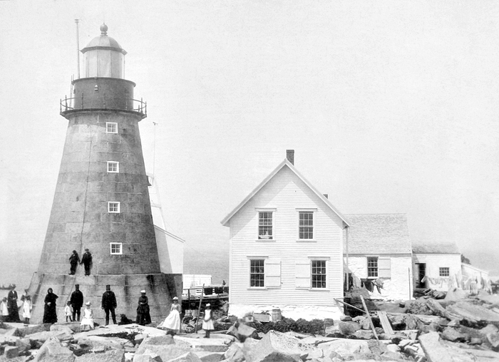
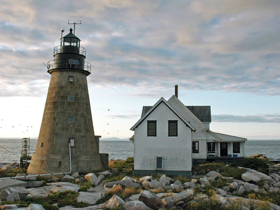
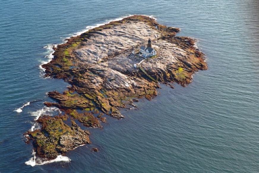
Mount Desert

Built in 1847, Mount Desert Lighthouse is located 18 miles off the coast of Maine on an island 600 yards long and 200 yards wide. It is considered one of the most remote places ever used for a lighthouse. In addition, the highest point is only 20 feet above sea level so flooding and total submersion are frequent events. Keepers had to be given eight days off every 21 days worked to recover from the isolation. It was automated in 1977 and is currently used as a whale research station. The first photo is undated.
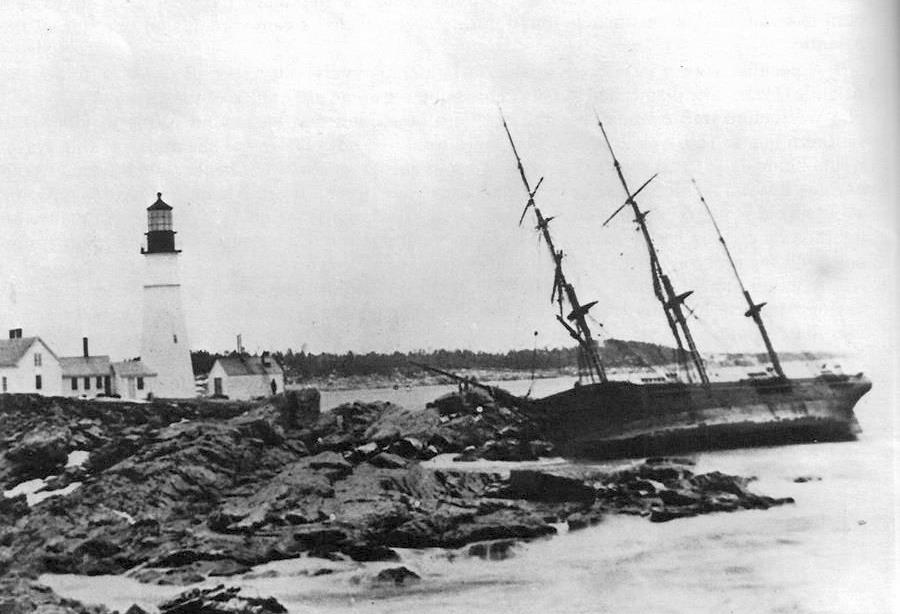
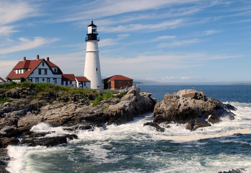
Portland Head

Portland Head Lighthouse is also located in Maine, but in a far more hospitable setting. It sits at the entrance to Portland Harbor near Elizabeth City. It was commissioned by George Washington and completed in 1791, making it the oldest in Maine. It was automated in 1989. The first photo is dated 1886.
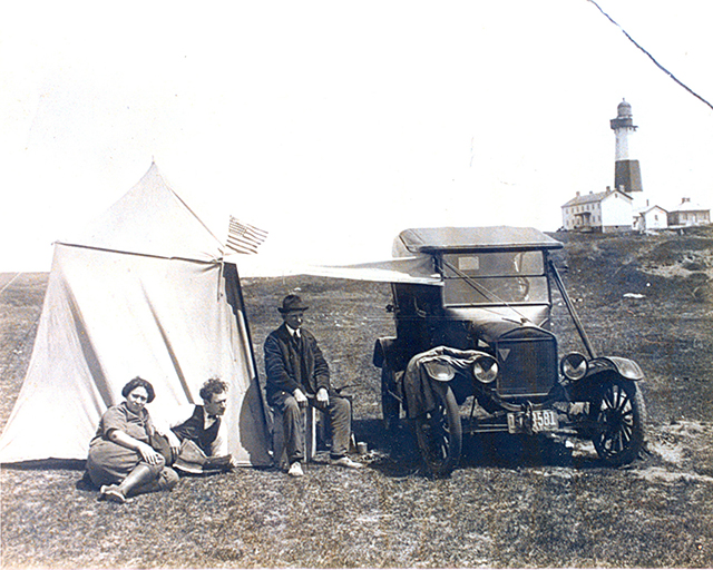
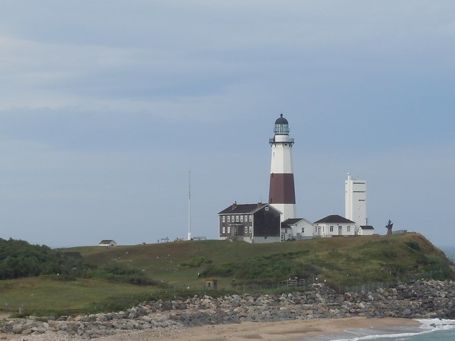
Montauk Point

Montauk Point Lighthouse is located on the eastern most point of Long Island NY. It was New York’s first lighthouse and now is the fourth oldest in the US. Construction was authorized by George Washington and it was finished in 1796. During much of its history it was a very isolated location, requiring a six-hour horseback ride to the nearest civilization. It was automated in 1987 and now operates as a museum. Originally the Lighthouse was 300 ft. from the ocean, but now is about 100 ft., necessitating a two-year, $31MM erosion protection project begun in 2021. The first photo is dated 1930.
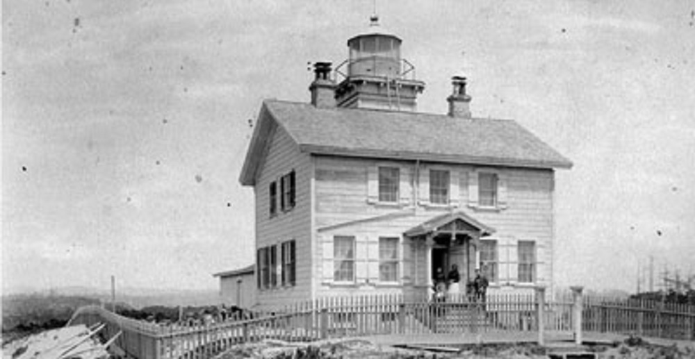
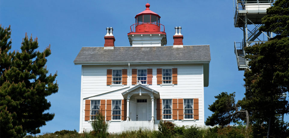
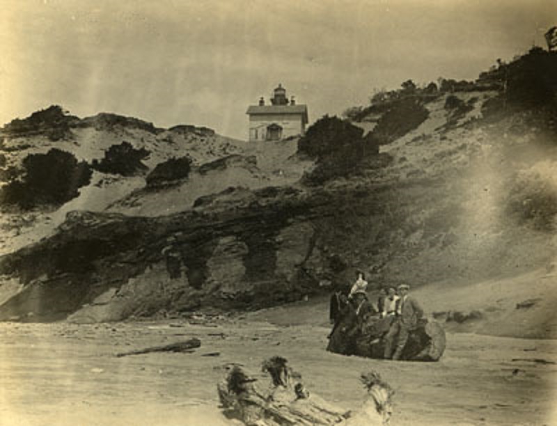
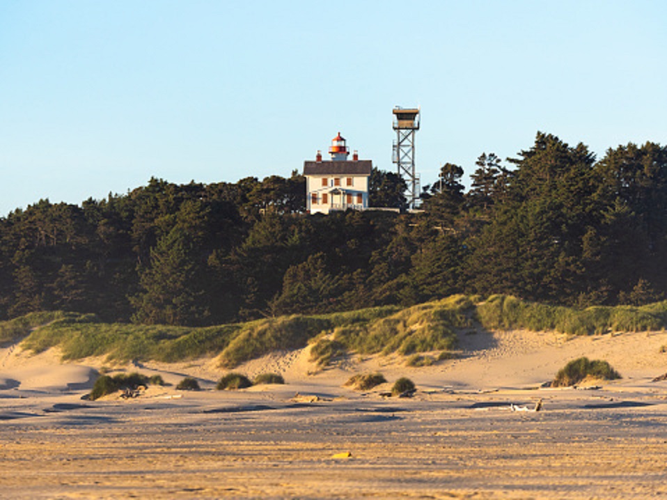
Yaquina Bay

Built in 1871 in Newport OR, Yaquina Bay Lighthouse was quickly rendered obsolete in 1874 by the Yaquina Head Lighthouse just four miles away. Yaquina Bay had various uses until 1934 when the state of Oregon made a 32-acre recreation area of the site. The light was re-lit in 1996. Now owned by the Coast Guard and open for tours, Yaquina Bay is the last of the original wood lighthouses on Oregon. The first photo is dated 1890 and the third is dated 1905.

Categories: Uncategorized | Leave a comment

Virginia City, MT

Virginia City along with Nevada City one mile away was the site of the richest gold strike in the Rocky Mountains. In total, the area is estimated to have produced over 100 million dollars. Virginia City was founded in 1863 and quickly became crowded with gold seekers. At its peak the population was 10,000. The town was particularly lawless which caused the formation of a vigilante group to help preserve order. In 1865 the state’s capitol was moved from Bannock to Virginia City . The town and surrounding area were designated a National Historical Landmark in 1961. While plenty of tourists visit, the population in 2020 was only 219. Like so many other former mining towns in the West, Virginia City MT has many surviving buildings. Some of the most interesting of those 100+ sites are:

Content’s Corner

When the legislature moved in 1865, it took up residence on the second floor of Content’s Corner with Siegel Clothing on the first. The first photo is dated 1867 and the third and fourth are undated.

Vigilante Headquarters and Storage.

The first photo is undated.

Dance and Stuart Mercantile Building.

The first photo is undated and the second shows the replica built in 1950s.

Gilbert Brewery

The Gilbert Brewery was founded in 1863, the same year as the town! Several additions were made to the building, but it still has its 1880s appearance and the original equipment is still in place. The site is now home to the Brewery Follies, a comedy cabaret. The first photo is dated ca. 1910.

Gilbert Home.

The Brewery’s owner is seen here with family and friends in this photo dated 1892.

Robbers Roost

Robbers Roost was a stage stop built in 1866, but, alas, no robbers ever roosted there. The first photo is dated 1890s.

Wells Fargo Office

The first photo is dated ca. 1875.

Categories: Uncategorized | Leave a comment

Beaches Part 2

Through the years, there has always been a large number of ways to enjoy the beach in addition to swimming and sun bathing, such as:

PLANES

Daytona Beach FL 1911

Stone Harbor CA. 1912

TRAINS

Orchard Beach, ME.

Margate, NJ

AUTOMOBILES

AND MANY OTHER MODES OF TRANSPORT

Categories: Uncategorized | Leave a comment

Beaches

Going to the beach as a fun activity began in the mid-19th Century in England and spread to the rest of the world in the late 1800s. Due to modesty in the Victorian Age, people stayed on the beach, out of the water. Later on, an odd invention appeared–the bathing machine. Made of wood and pulled by a horse, it gave women, primarily, the chance to go in the water, but still be in keeping with the standards of the times.

Later, of course, times changed and beach activities and fashion changed dramatically.

Two of the most popular beaches in the U.S. at the beginning of the 20th Century were:

Asbury Park, NJ. The first two photos are dated ca.1905.

Atlantic City NJ The first two photos are dated 1904.

In the Midwest, Oak St. Beach in Chicago was popular as seen in this 1929 photo.

On the West Coast, near San Francisco, Ocean Beach with its haunting Cliff House attracted crowds. There have been four Cliff Houses on the site since 1863. The one shown (#2) burned in 1907. The first photo is dated 1890 and the second is dated 1895.

Further south is Santa Monica Beach seen in this 1920s photo.

Categories: Uncategorized | Leave a comment

Fredericksburg, TX

Fredericksburg is located in central Texas, about 78 miles west of Austin. It was founded in 1846 and is best known for its German heritage and numerous wineries, over 50 in the county. Southern Living magazine voted it the best small town in Texas, part of the magazine’s best small towns in the South listing. Numerous other impressive accolades can be found at visitfredericksburg.com. Among the town’s many interesting sites are:

Vereins-Kirche Building

The original building occupied the middle of Main Street for 50 years and was used as a meeting place, church, and school. The first photo is dated 1896–the year the building was demolished. The second photo shows the dedication of a replica in 1935. It is now the Pioneer Museum.

Main Street as seen in this late 1800s photo.

Blum Building in an undated photo.

Nimitz Hotel, now the National Museum of the Pacific War. Photo is undated.

Preiss Building in an undated photo.

Central Hotel in an undated photo. Current photo is credited to the occupant–The Fredericksburg Good Art Co.

Railroad Tunnel seen here in a 1912 photo.

Categories: Uncategorized | Leave a comment

Harpers Ferry Part 2

High Street

WW1 soldiers are seen here marching down High Street ca.1918. Second photo is thanks to David T. Gilbert.

Shenandoah Street ca.1900

Note St. Peters Church sitting prominently above the town. The street along side is part of the Appalachian Trail.

Stairs leading to St. Peters Church. The first photo is undated and the second is dated 1891.

Jefferson’s Rock.

A path along side of St. Peters Church leads to Jefferson’s Rock, named for Thomas Jefferson who visited the site in 1783. He said of the view “This scene is worth a voyage across the Atlantic.” The rock once swayed with a slight push so four stone pillars were installed in the 1850s. The first photo is undated and the second is dated 1920.

Categories: Uncategorized | Leave a comment

Harpers Ferry Part 1

Harpers Ferry is a small, (pop.285), historic town at the confluence of the Shenandoah and Potomac Rivers. During the Civil War, it was the northern most point of Confederate controlled territory and was the site of John Browns Raid in 1859. Most of the town was destroyed in the Civil War and was again extensively damaged in the Flood of 1936. The area known as Lower Town was rebuilt by the National Park Service which then created Harpers Ferry National Park. The Park encompasses much of the town and surrounding area as seen on this map.

Appalachian Trail hikers consider Harpers Ferry the halfway mark on the 2,190 mile trek.

Major sites in the area include:

Town View from Overlook Cliff (Maryland side) Photo dated 1861.

An in-town view showing John Brown’s Fort in 1862. Originally built as a firehouse, the building was relocated across the street in 1968, and a monument was erected on the former location. Note the same red building appears in all three photos. For more information on the building, see this blog March 2017.

Lock 33 on the C&O towpath located directly across the Potomac River from Harpers Ferry at the base of Maryland Heights. The first photo is dated 1900. Note the old lock house ruins in the second photo.

Lower Town in a photo dated 1880.

Categories: Uncategorized | Leave a comment

Balancing Rocks Part 2

Duck Rock. Chiricahua National Monument. Photo dated 1940s

Garden of the Gods CO. Photo dated 1894.

More rocks without the “then” starting with Big Bend TX.

Petrified Forrest AZ.

Chiricahua National Monument CO.

Mushroom Rock KS.

Arches National Park CO.

Categories: Uncategorized | Leave a comment

Balancing Rocks Part 1

Most balancing rocks occur as a result of being deposited by glaciers or eroded by wind and water. Some of the more impressive ones are:

North Salem NY. Photo is undated.

Pittsfield MA. Photos are undated.

Balanced Rock Pittsfield, MA

Twin Falls ID. Forty tons of rock balancing on a 3 foot 17 inch base! Photo is dated 1937.

Camden ME. First photo is dated 1889. Second is undated.

Categories: Uncategorized | Leave a comment

Boston Part 2

Quincy Market

Quincy Market opened in 1826. It has grown to include Faneuil Hall and two other historic buildings and is now known as Faneuil Hall Marketplace. The first photo is dated ca. 1904.

Revere House

Paul Revere’s house was built in 1680 and is downtown Boston’s oldest building. Many commercial tenants occupied it until 1908, when the Paul Revere Memorial Association was formed to ensure it would not be demolished. The first photo is dated 1898.

South Station

New England’s largest railroad station opened in 1899 and, by 1913, was the busiest in the world. The first photo is undated.

Temple Place

Temple Place is an historic district comprised of 15 well-preserved buildings, the earliest is from the 1830s. The first photo is dated ca. 1915.

Tremont Street

The first photo is dated 1895 and the second is from 1904.The third photo is credited to Derek Strahan from his book and website Lost New England. For a deep dive into Boston then and now, check out his website. It has 46 pages on the city!

Categories: Uncategorized | Leave a comment