You are using an insecure version of your web browser. Please update your browser!
Using an outdated browser makes your computer unsafe. For a safer, faster, more enjoyable user experience, please update your browser today or try a newer browser.
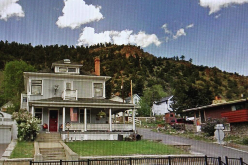
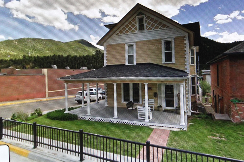
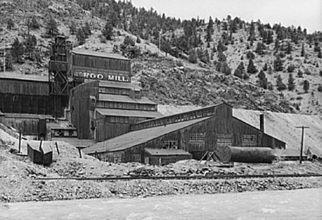
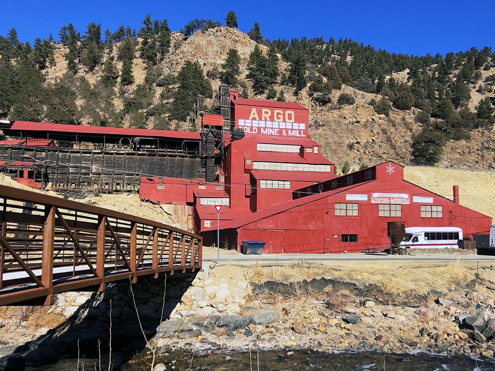
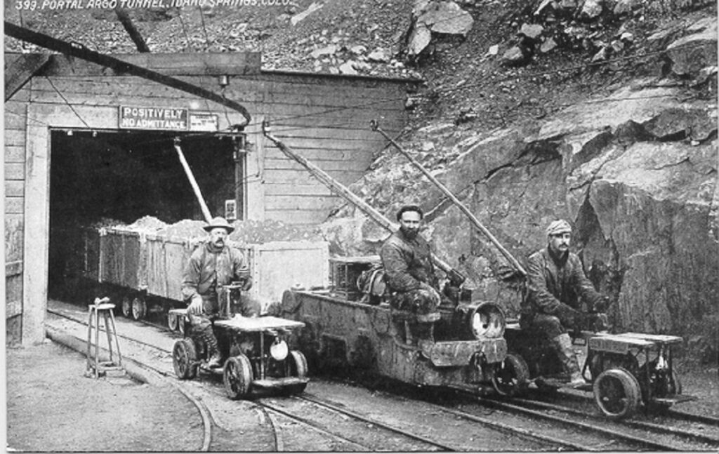
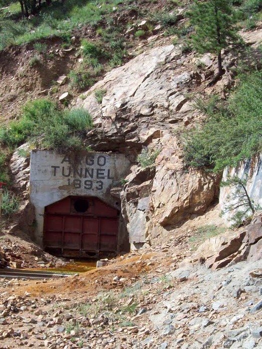
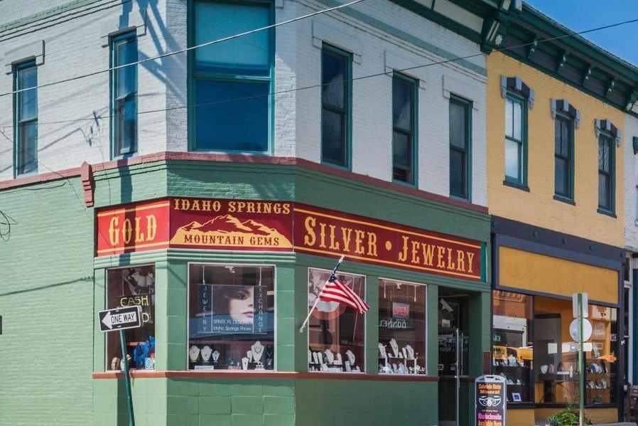
Idaho Springs is a small town (pop.1,858) 30 miles west of Denver. It was founded in 1859 during the Pikes Peak Gold Rush. The original Argo Mill is still intact. It sits outside the Argo Tunnel, which was built from 1893-1910, to facilitate removal of ore from numerous mining regions in the area. At one time it was the largest mill and tunnel operation in the world. Currently, it is a popular tourist attraction. The first photo is dated 1941 and the third 1910.
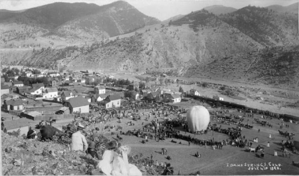
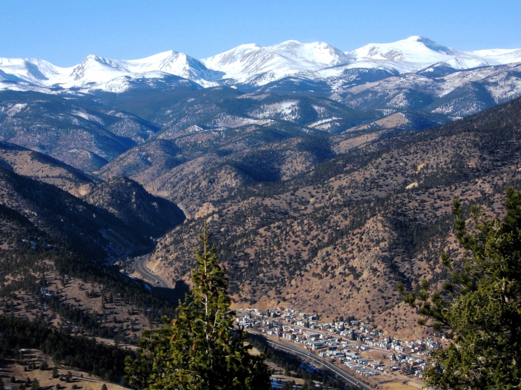
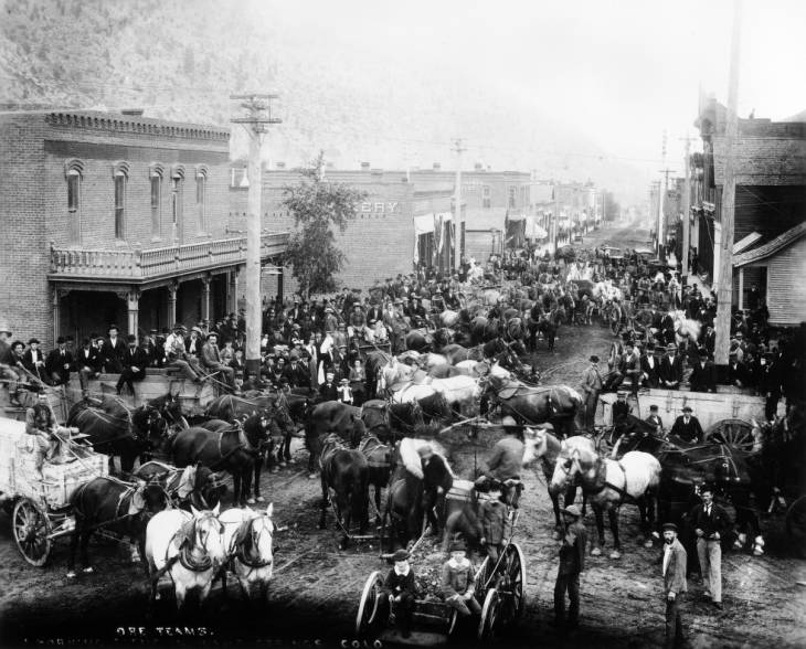
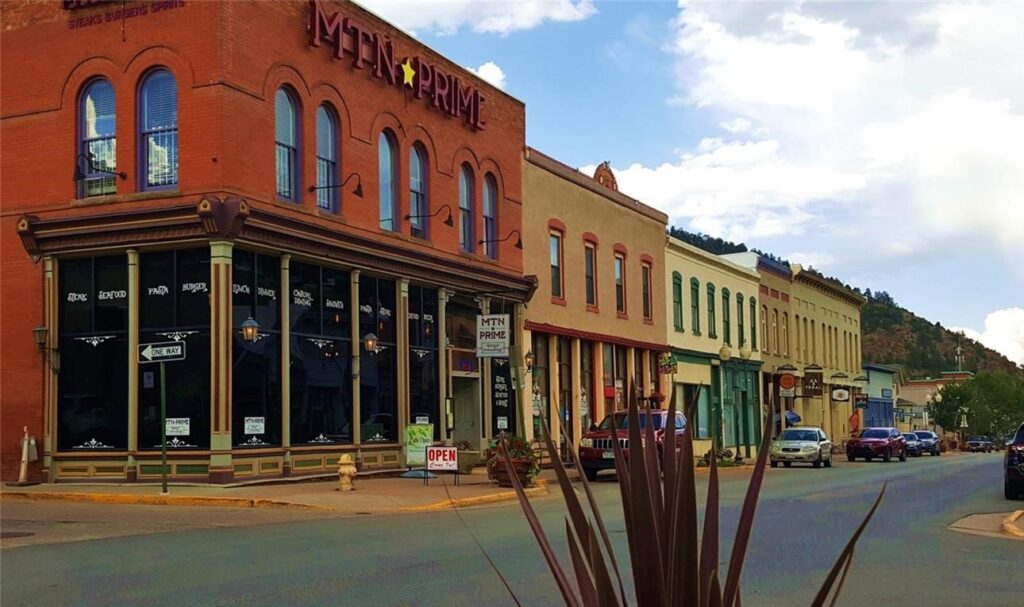
The town offers a beautiful mountain setting with many historic buildings to tour. The first photo shows the town during a July 4th parade in 1890.
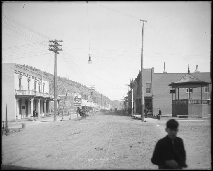
A busy Miner St. in 1894 and a bit less busy in an undated photo.
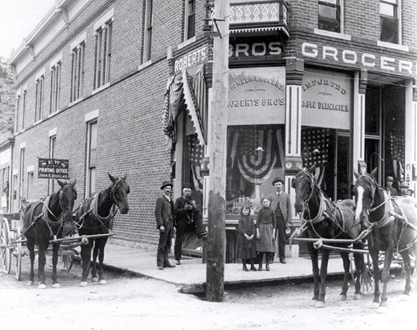
Roberts Bros. Groceries, which operated from 1886-1917.
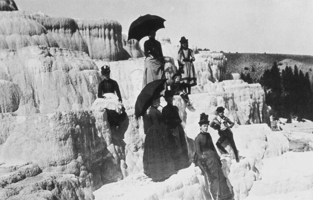
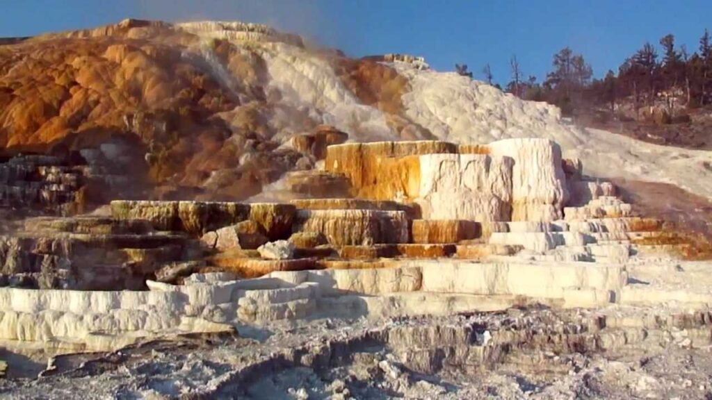
Yellowstone spans over 2.2 million acres (over 3,400 square miles) in three states–Montana, Idaho, and Wyoming. It was established as a National Park in 1872. In fact, the concept of a national park anywhere in the world started with Yellowstone. For more, see this blog April/May 2014. The first photo is Mammoth Hot Springs and is dated ca. 1885.
Glacier
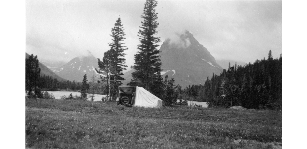
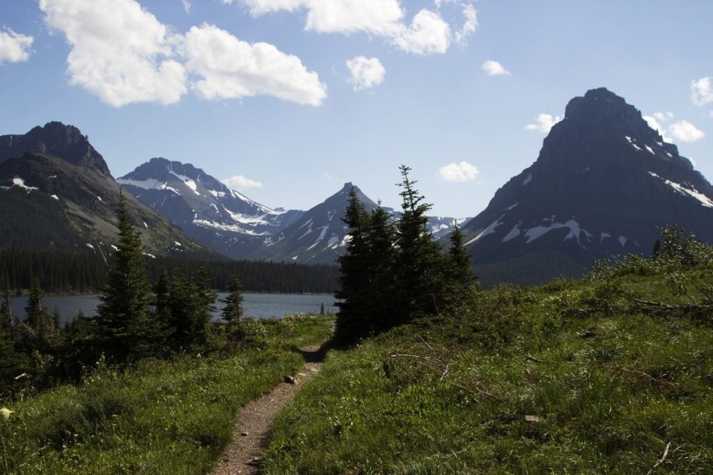
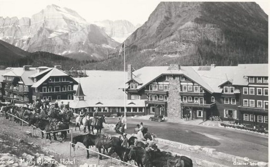
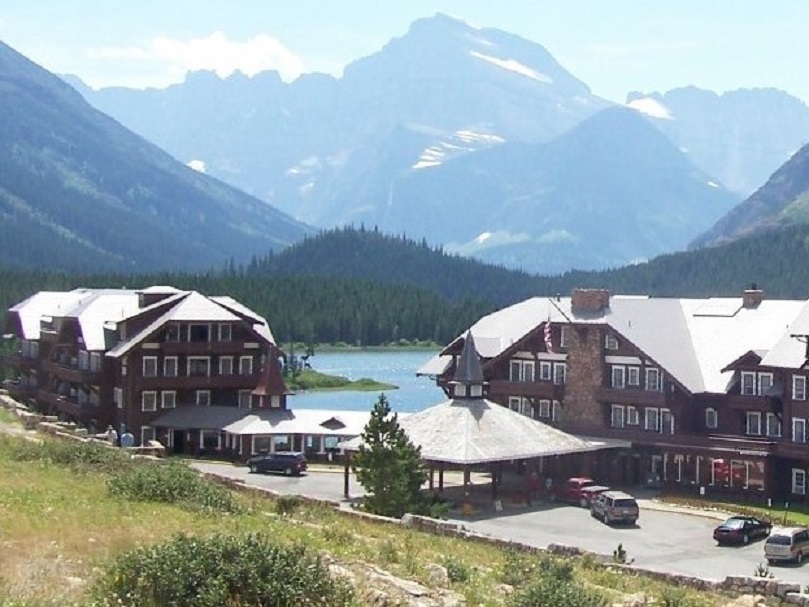
Glacier National Park is located in northwest Montana. Its northern border is also the US/Canadian border. It spans about 1 million acres (1,600 square miles) and was established in 1910. The first photo shows Two Medicine Lake in 1927, and the third shows Many Glaciers Hotel in 1934.
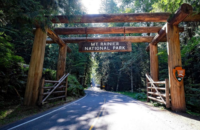
Mount Rainier
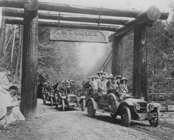
One of three national parks in Washington, Mount Rainier National Park is located in the south-central portion of the state, near Tacoma. It spans 236 million acres (370 square miles) and was designated a National Park in 1899. The first photo is dated 1912.
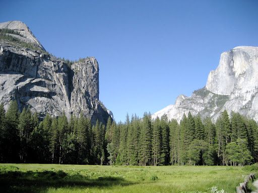
Yosemite
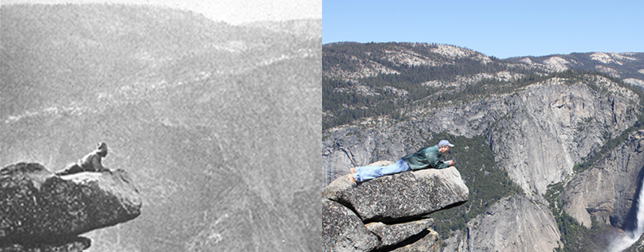
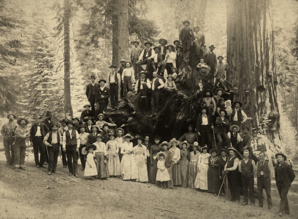
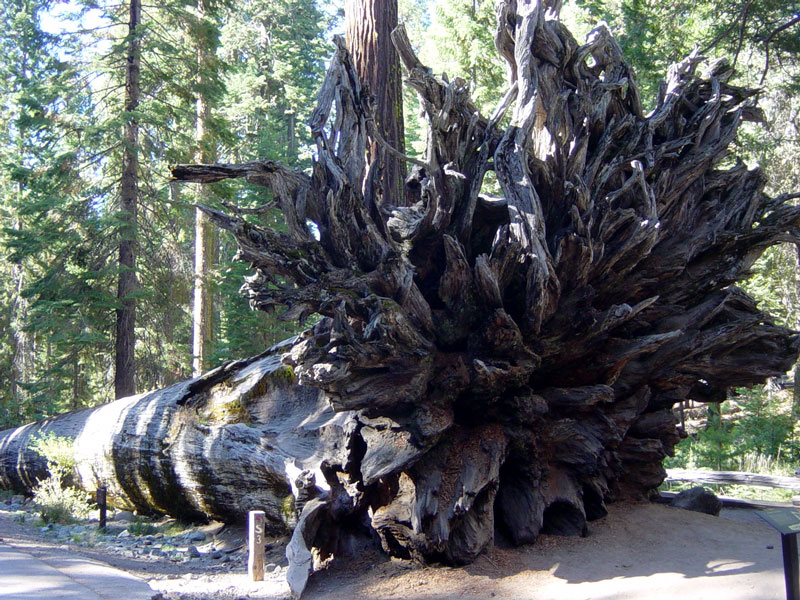
Yosemite National Park is located in the east-central portion of California, near Mariposa. It spans 236 million acres (370 square miles) and was established in 1890. For more information, see this blog June 2013. The first photo is dated 1927, and the third shows The Fallen Monarch sequoia in Mariposa Grove in the park in 1891.
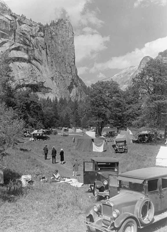
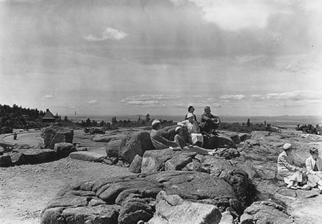
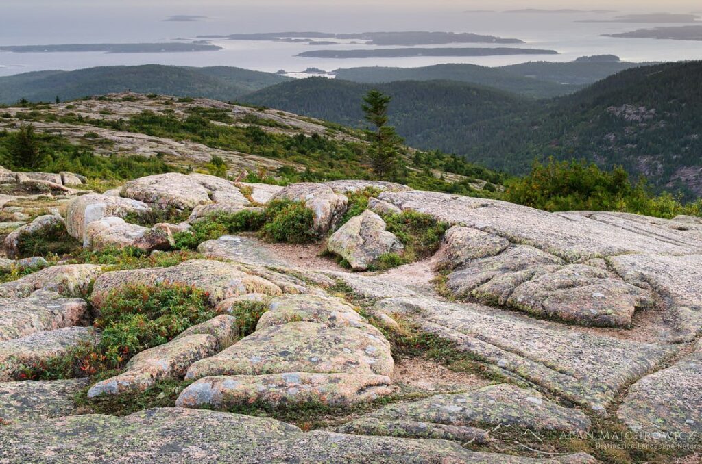
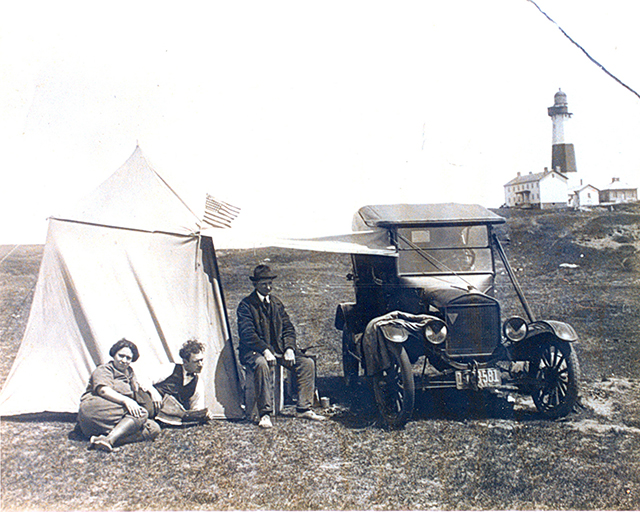
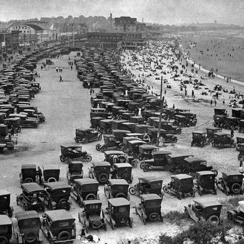
Visiting a national park was an idea that caught on right away. In 1929, there were three million visitors. By 1941, that number rose to 20 million and by 2019 the number was 327 million. At first, the railroads were the preferred mode of transport. That switched with the advent of the automobile, which helped fuel the spike in attendance, as did the rapid rise in the number of national parks. Below are several photos of early visitation along side of the current view.
Big Bend
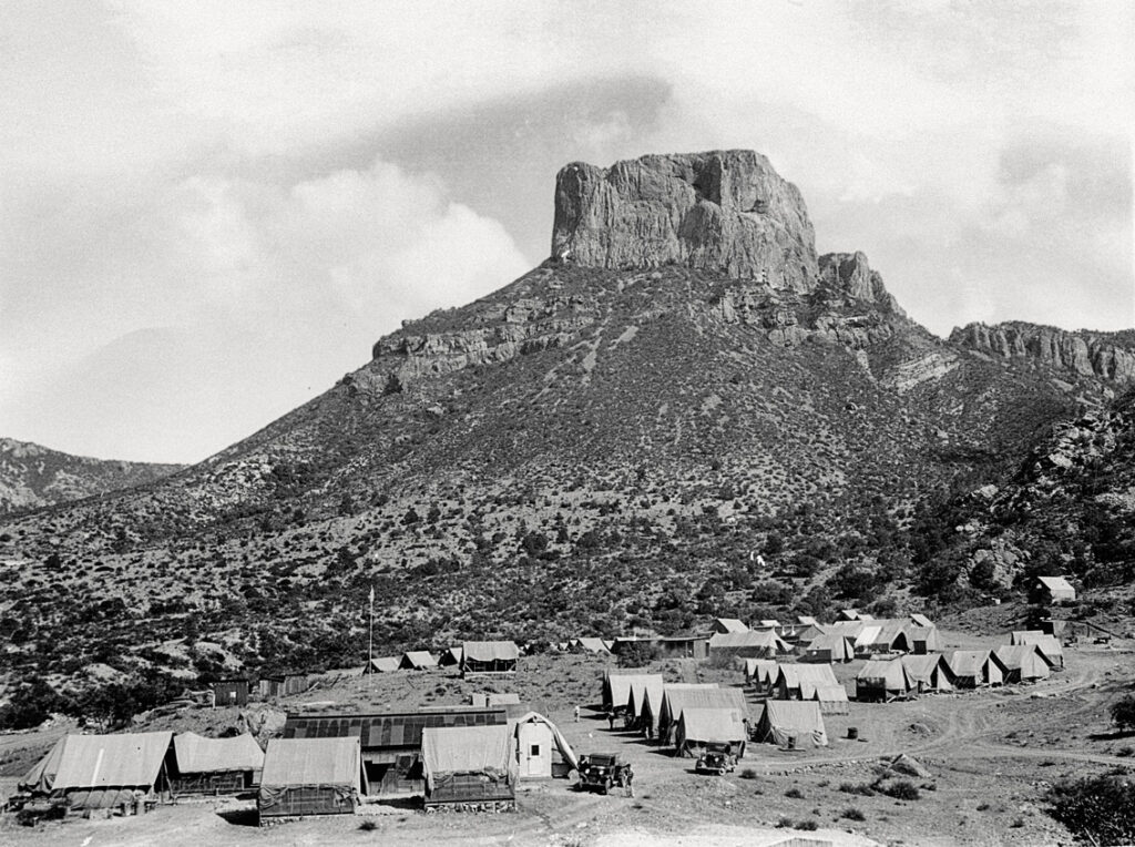
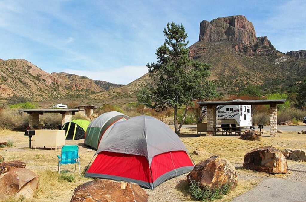
Big Bend is located in west Texas and consists of 800 acres (1,250 square miles). It became a national park in 1944 and is named for the large bend in the Rio Grande River, which flows on the U.S./Mexico border. It is one of the largest of the national parks. It is also one of the most remote, which accounts for its having the darkest skies in the Lower 48. Only about 400,000 people visit annually. The first photo shows a Civilian Conservation Corps camp in 1930.
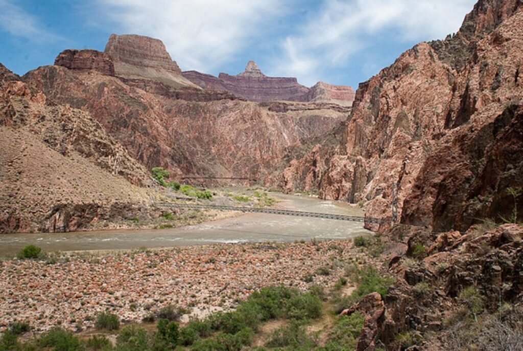
Grand Canyon
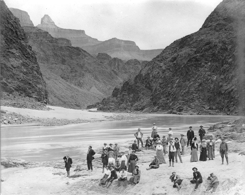
The Grand Canyon is located in northwest Arizona and comprises 1.2 million acres (1,900 square miles). In contrast to Big Bend, it is very accessible. Annual visitation is six million, second in attendance only to Great Smoky Mountains National Park. The first bill to establish National Park status in 1882 failed, and it was not until 1919 that it passed. The first photo is dated 1906.
Acadia
Acadia National Park is located in the middle of Maine’s Atlantic Coast. When established in 1929, it became the first National Park east of the Mississippi River. It has 49,000 acres (77 square miles) and Maine’s tallest mountain–Cadillac Mountain at 1,530 ft. Annual attendance is about four million. The first photo is dated in the 1930s.
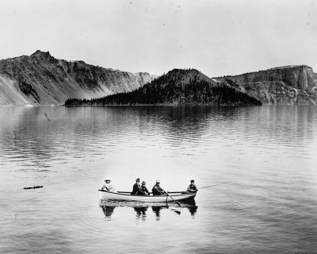
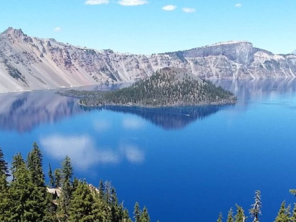
Crater Lake
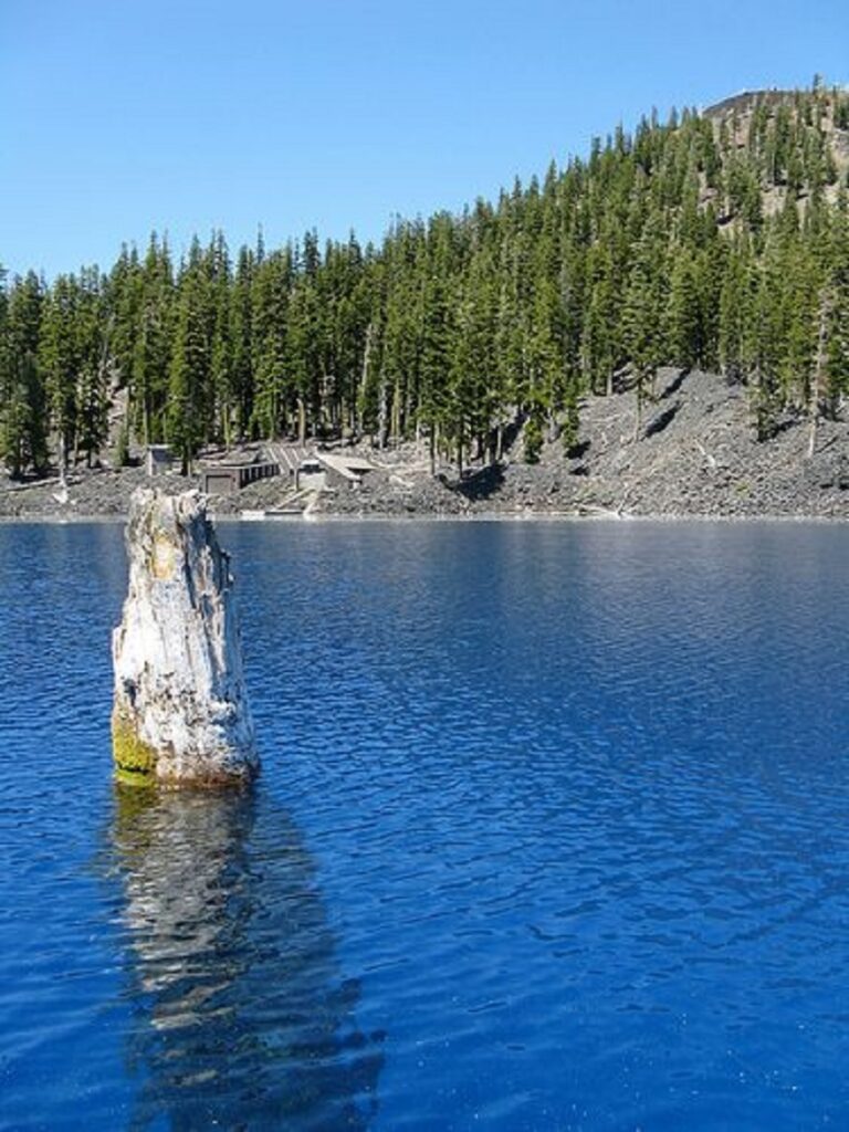
Crater Lake National Park was established in 1902 and is located in the Cascade Mountain Range of southern Oregon. It has about 184,000 acres, and the lake itself resides in the caldera of a dormant volcano. At a depth of 1,900 ft., it is the deepest lake in the U.S., deeper than the heights of the Eiffel Tower, the Statue of Liberty, and the Washington Monument combined! It is home to The Old Man of the Lake–a 450-year-old, 30-ft. hemlock that has been floating upright four feet above the water for well over 100 years. A study in 1938 showed that it traveled 62 miles in three months. The first photo is dated 1912.
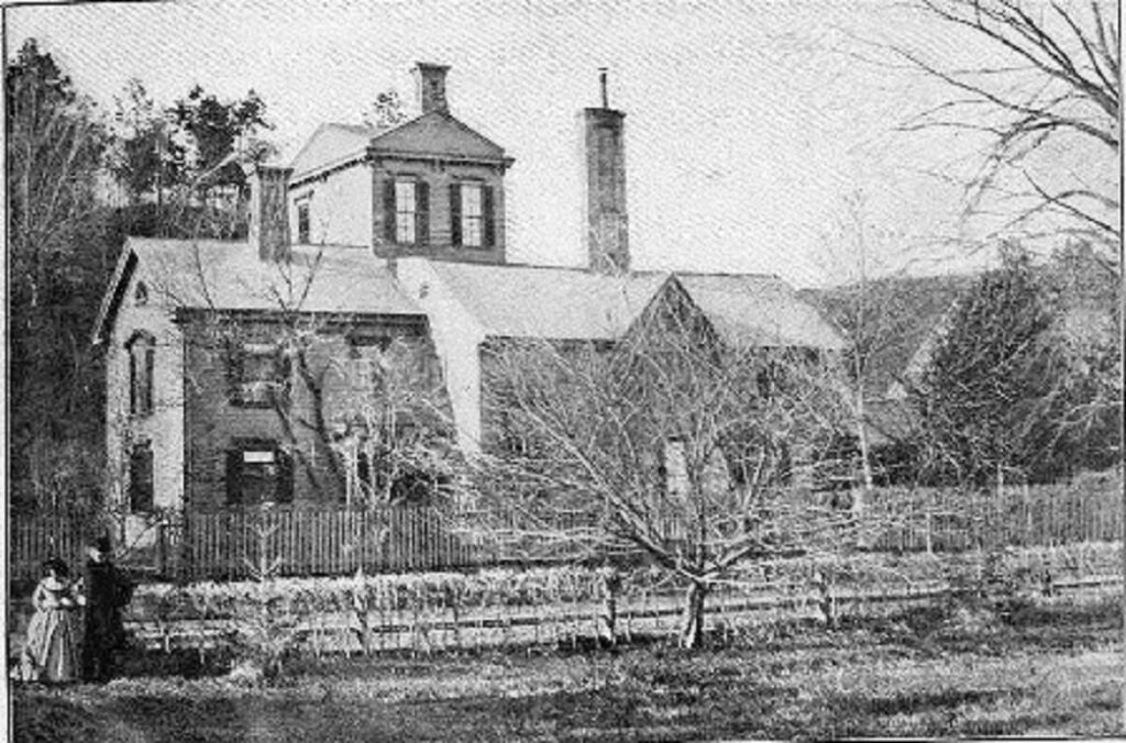
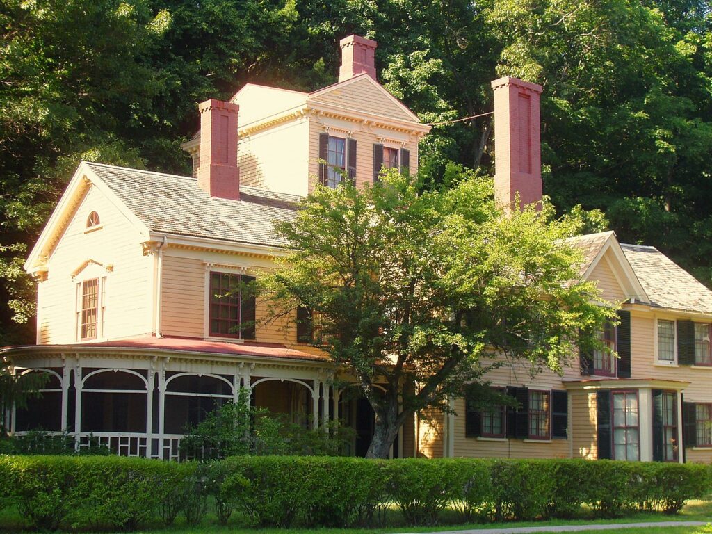
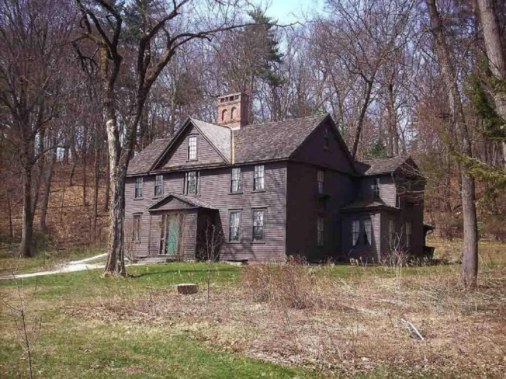
The building known as the Wayside dates back to 1717. It was named Hillside by the Alcott family who resided there from 1845-52 when they moved into the adjacent Orchard House. In 1852, Nathaniel Hawthorne moved in and renamed the structure The Wayside due to its proximity to the road out front. It was acquired by the National Park Service in the 1960s and opened to the public. The first photo is dated in the 1860s.
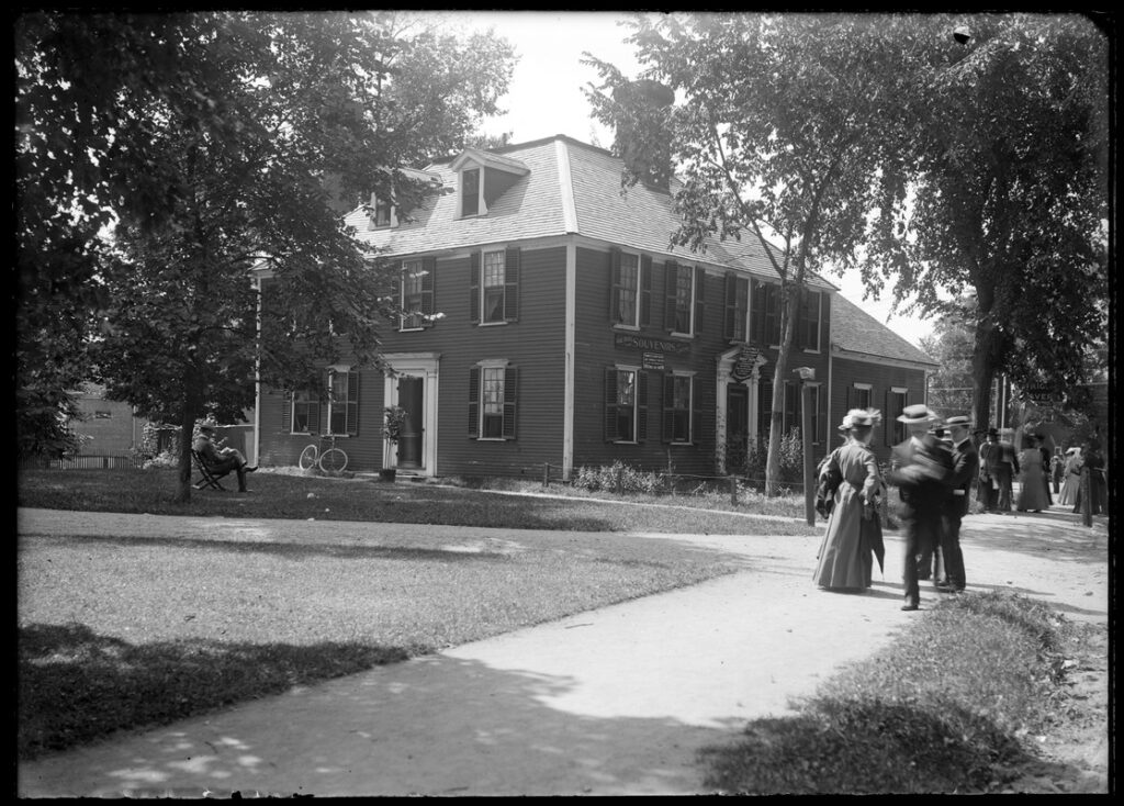
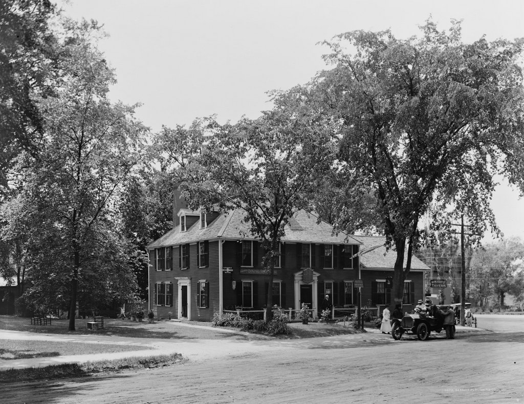
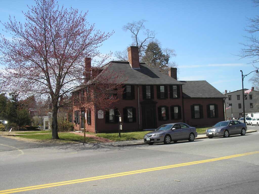
Wright’s Tavern
Wright’s Tavern was built in 1747 in the heart of Concord. In April of 1775 it was the meeting place of Concord’s Minute Men, who then left to fight the 700-man British Army. Many mercantile occupants and renovations occurred over the years. It is now owned by the First Parish Church and is used by the Concord Museum as an educational space. Plans are to renovate the building and re-open in October 2024 as the “Center for the Exploration and Renewal of Democracy.” The first photo is dated 1904 and the second 1915.
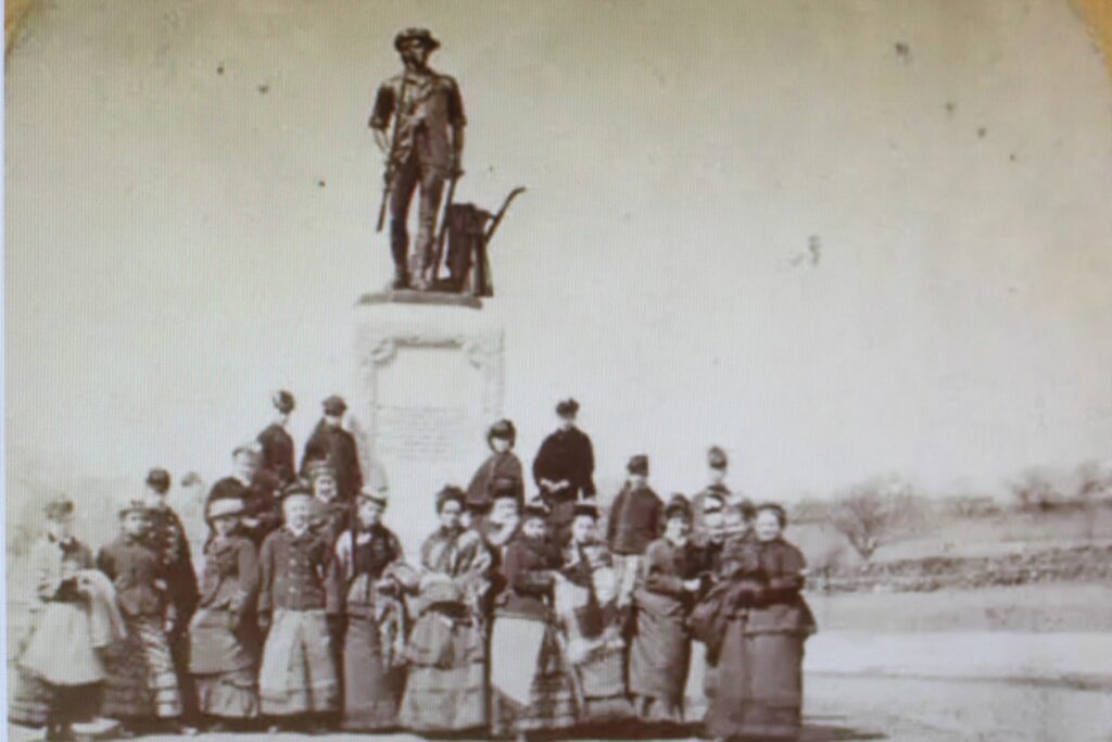
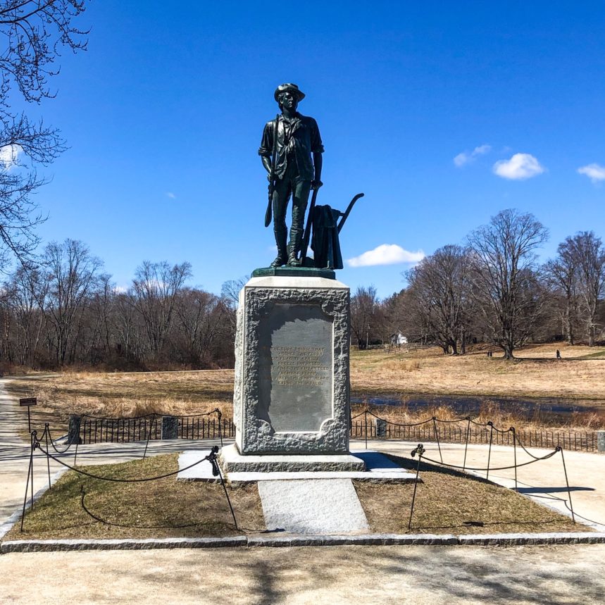
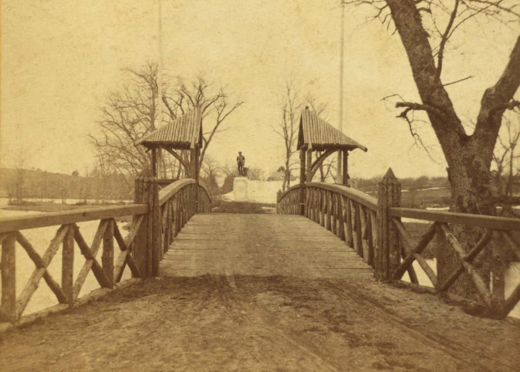
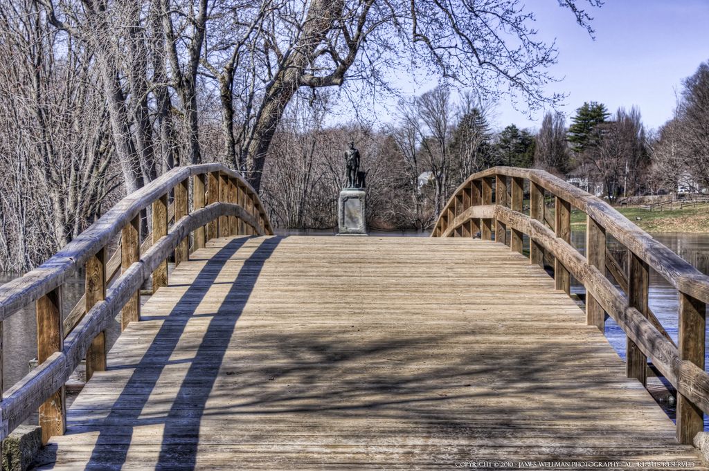
The Minute Man Statue
The Minute Man statue was erected on April 19, 1875, to commemorate the centennial of the Battle of Concord. It should not be confused with the Minuteman Statue in Lexington. The first photo is dated 1875, and the second is credit to Derek Strahan.
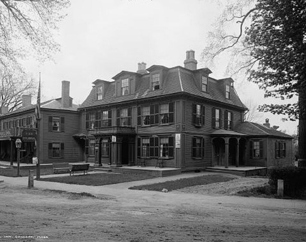
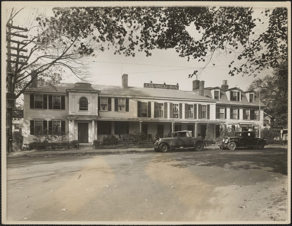
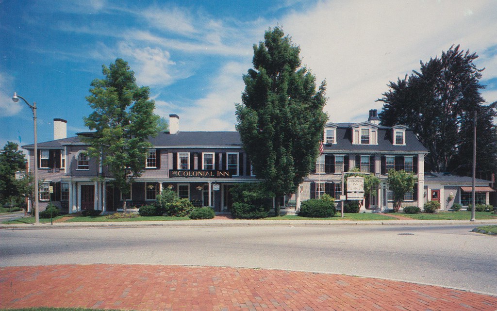
Colonial Inn
Just a 14-minute walk from the Minute Man Statue is the Colonial Inn, built in 1716. It has been operated as a hotel since 1889. The original three separate buildings were combined into one in 1897. The first photo is dated ca.1908. Note the three chimneys in the second photo dated 1929, which show the original three sections.
Concord MA is located 20 miles west of Boston. It was established in 1635. A British raid on a military armory led to the Battles of Lexington and Concord in 1775. In the mid-1800s it was home to such notables as Ralph Waldo Emerson, Henry David Thoreau, Nathaniel Hawthorne, and Louisa May Alcott. In 1849 the Concord Grape was developed, and the original vines are still producing. Numerous historical sites abound some of which are:
Downtown
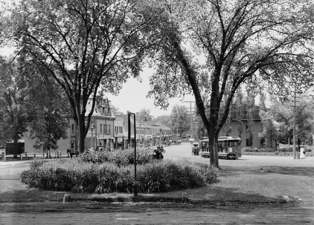
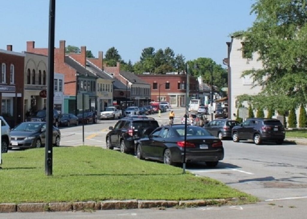
Main St. in Concord offers well-preserved history with no tourist tackiness. Most of the popular sites are less than one mile from each other. The first photo is dated ca. 1915. The second is credit to Derek Strahan.
Anderson’s Grocery Building
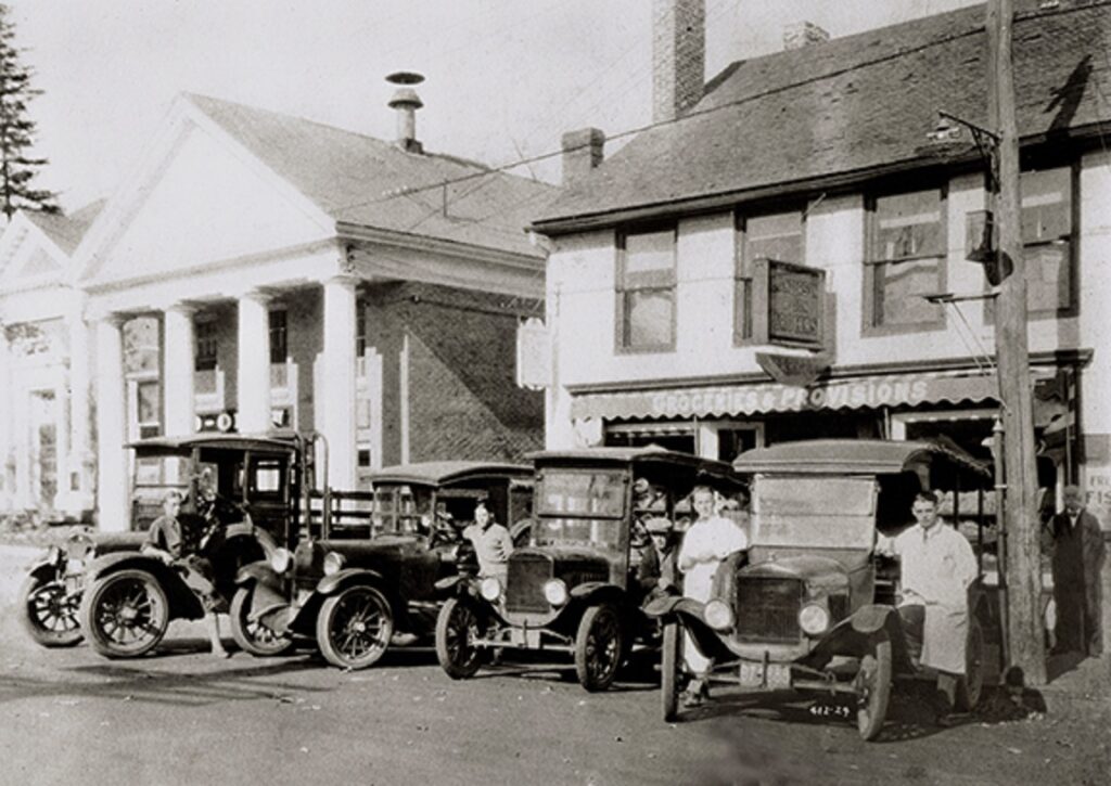
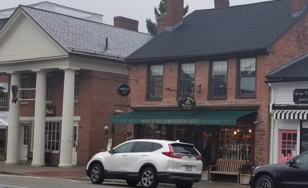
This building was surveyed by none other than Nathaniel Hawthorne in 1853! Over time it had numerous commercial occupants, including a grocery store opened by Lars Anderson in 1913. It is now the Main Streets Market and Cafe owned by the fourth generation Anderson family. The first photo is dated 1924.
Old North Bridge
Old North Bridge (aka Concord Bridge) is the site of “the shot heard ’round the world.” Since then, seven more bridges have been built on the site. The current one from 1956 is a replica of the one from the April 19, 1775 battle. The first photo is dated 1880.
The Old Manse
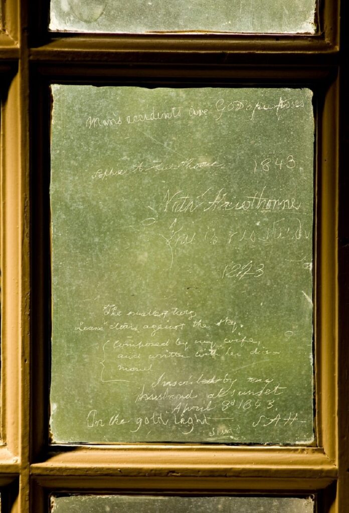
The Old Manse was built just in front of the Old North Bridge in 1770. Ralph Wadso Emerson lived there from 1834-35. Nathaniel Hawthorne lived there with his wife from 1842-45. In 1843, he and Sophy etched poems on a window using her diamond (see below). The first photo is dated 1890.
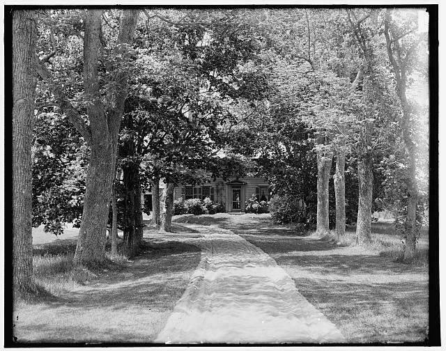
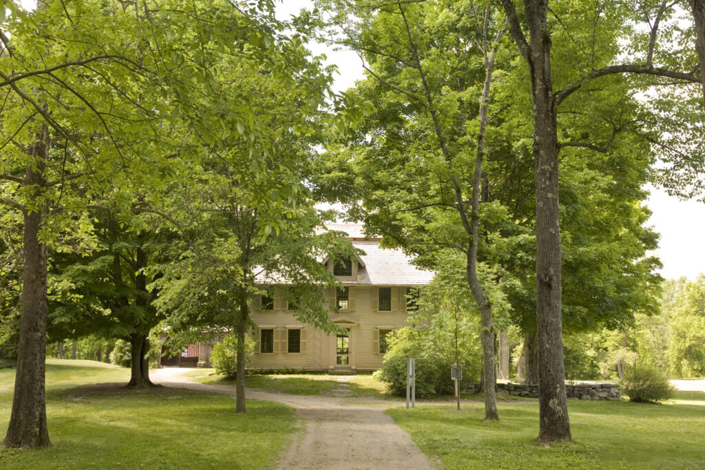
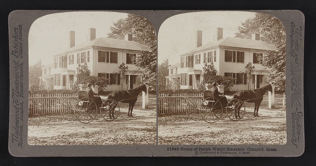
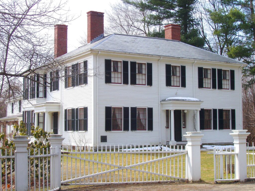
Emerson House
This house was built in 1828 and lived in by Ralph Waldo Emerson from 1835-1882. It is still owned by the Emerson family. In 1930, it opened as a museum containing the original furniture. The first photo is dated 1914.
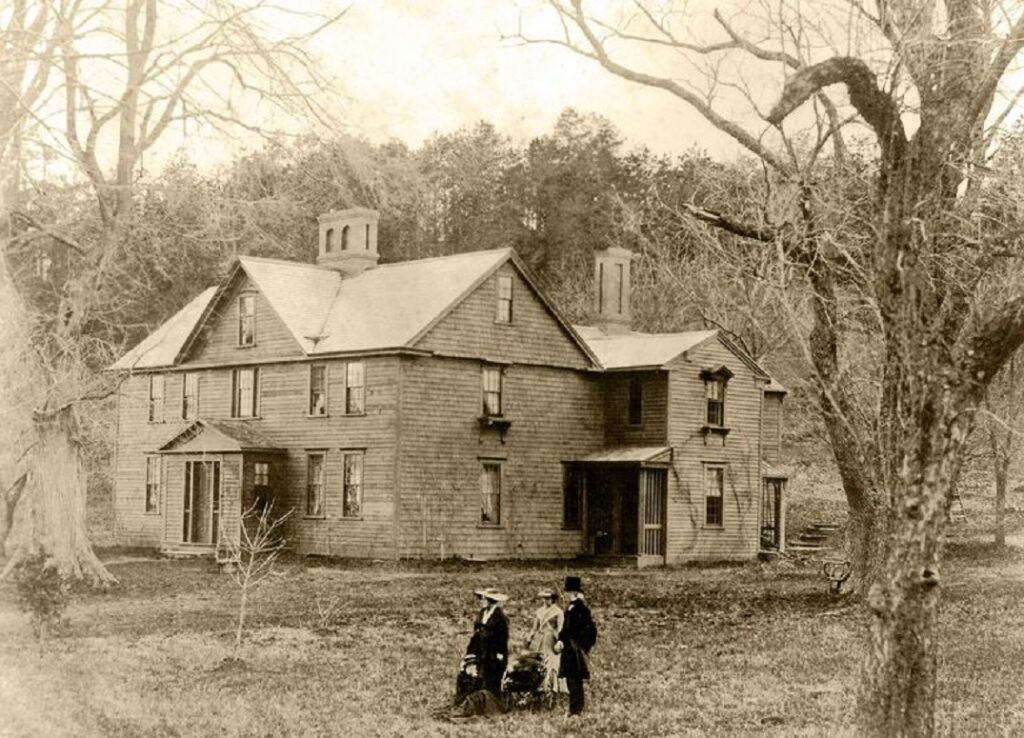
Orchard House
Originally two buildings when built in 1675, the Orchard House was combined into one in 1857 when it was purchased by Bronson Alcott. His daughter–Lousia May Alcott–wrote Little Women there in 1868. In 1912 it opened as a museum also with most of the original furnishings. The first photo is dated ca.1865.
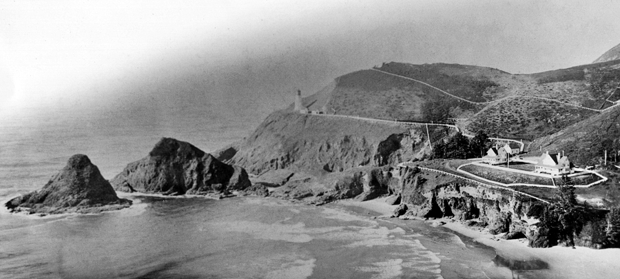
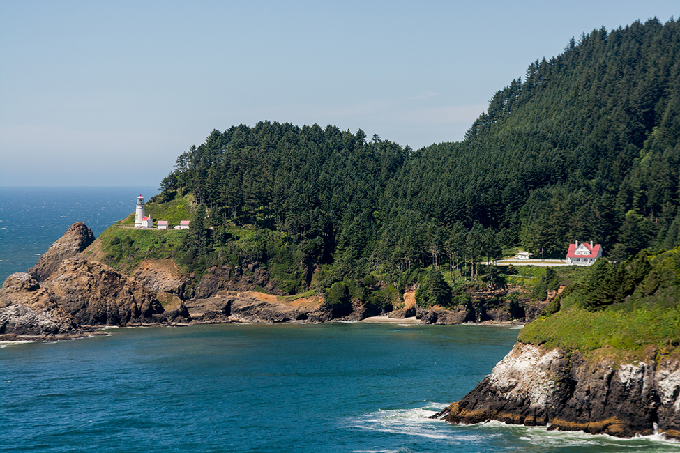
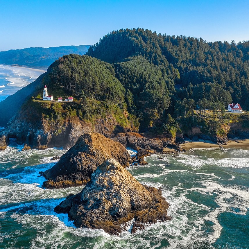
Heceta Head Lighthouse is located two hundred feet above the Pacific Ocean along the Oregon Coast near Florence. It was built in 1894 in a location so remote one teacher taught all eight grades in the school. It was automated in 1963 and now is an Oregon state park with hiking trails and a B&B in the refurbished keeper’s home. The first photo is undated.
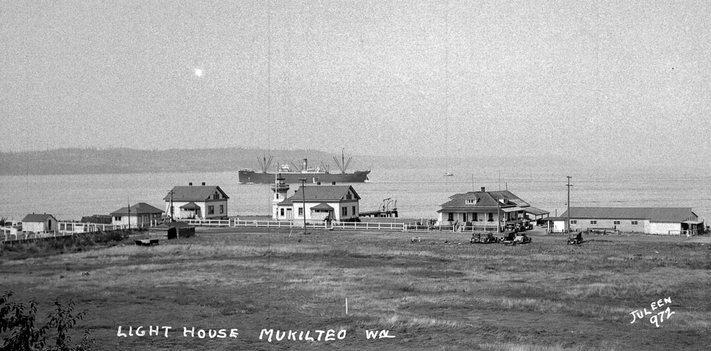
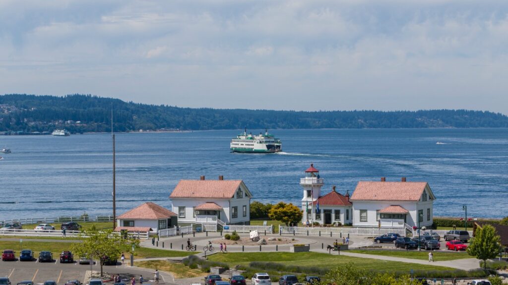
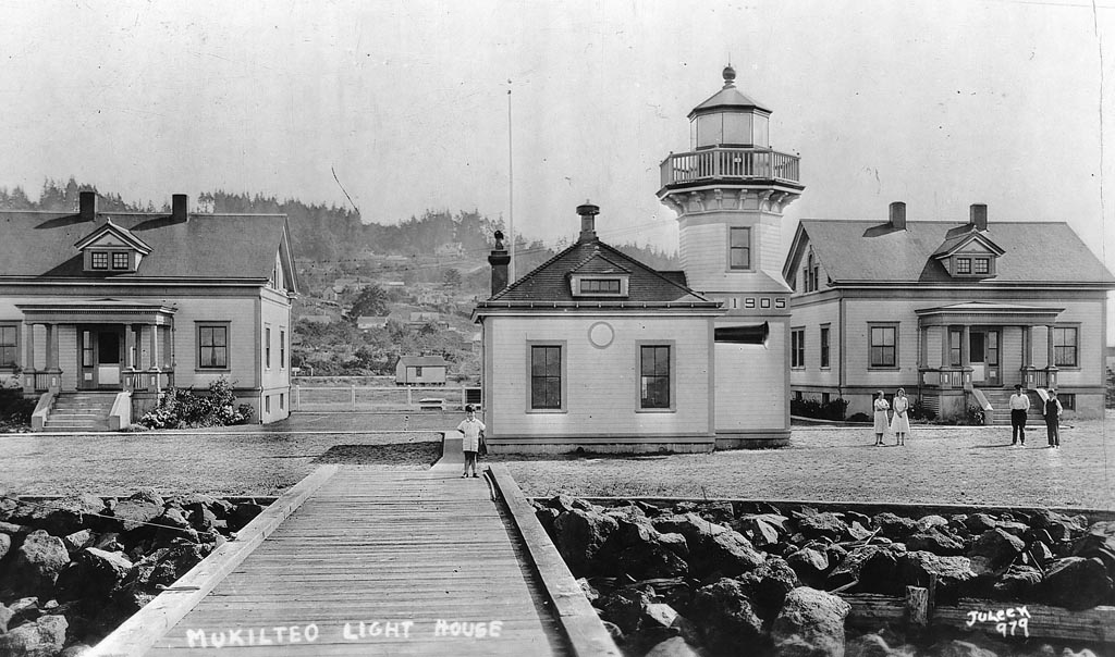
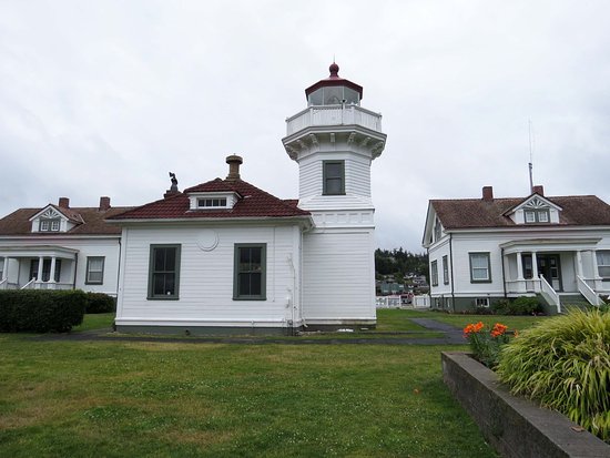
Mukilteo
Mukilteo Lighthouse near Everett WA was built in 1906. It was automated in 1979 and is now a city park that is often rented for weddings. The first and third photos are dated ca.1920.
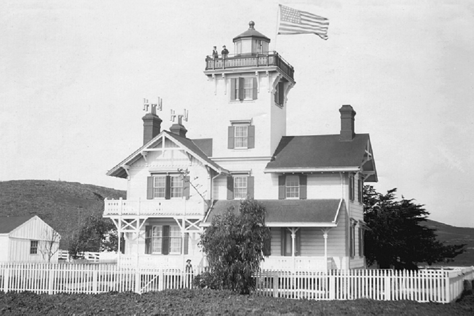
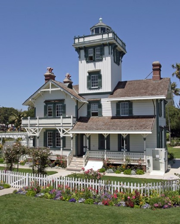
Point Fermin
Point Fermin Lighthouse is located in San Pedro CA. It was built in 1874, making it one of the oldest on the West Coast. The ornate Victorian keeper’s house has appeared in numerous TV shows, including Hart to Hart, Murder She Wrote, and MacGyver. It was saved from demolition in 1972 and underwent a 2.6 million dollar renovation in 2002. The first photo is dated 1880.
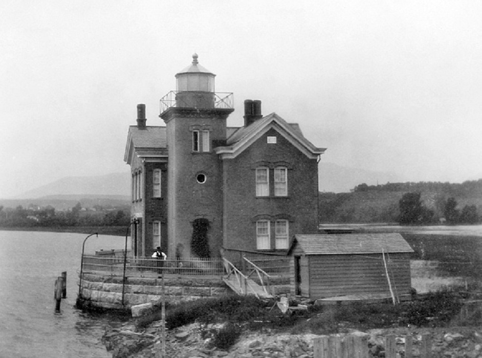
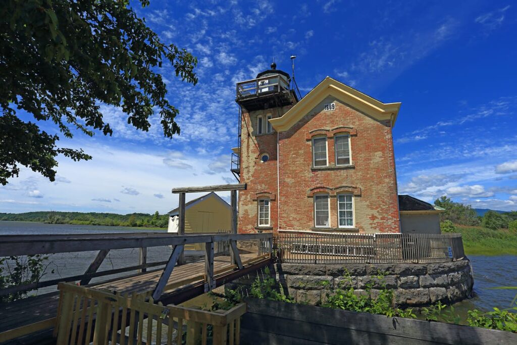
Saugerties
Saugerties Lighthouse is located on the Hudson River near the town of Saugerties NY. It was built in 1869 and closed in 1954. It was also slated for demolition in the 1960s but was saved and is now a museum with two B&B rooms. The first photo is dated 1885.
Stratford Point
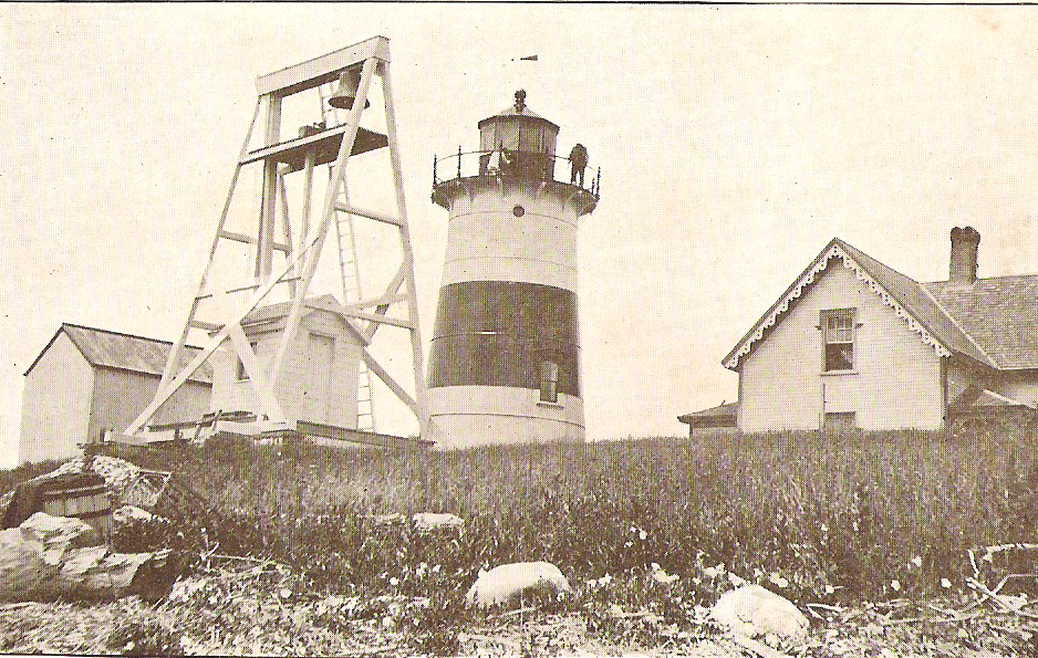
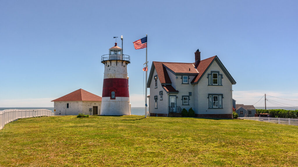
Stratford Point Lighthouse is located at the mouth of the Housatonic River in Connecticut. The present tower was built in 1881 and was one of the first prefabricated cylindrical lights in the U.S. It was automated in 1970 and is now a private dwelling not opened to the public. The first photo is dated 1880s.
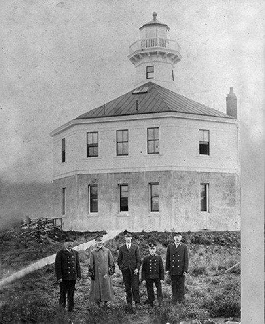
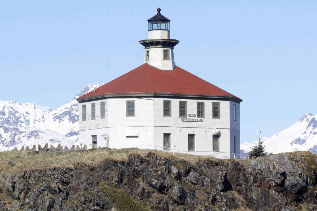
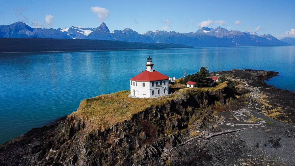
Eldred Rock Lighthouse is located 55 miles north of Juneau Alaska. It opened in 1906 and is the oldest lighthouse built in Alaska. It was automated in 1973 and now provides weather and seismic data. The first photo is dated 1906 and shows the original three lighthouse keepers in uniform. The third photo is credited to Alex McCarthy of the Juneau Empire.
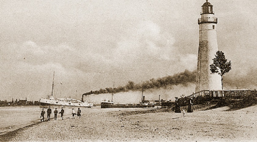
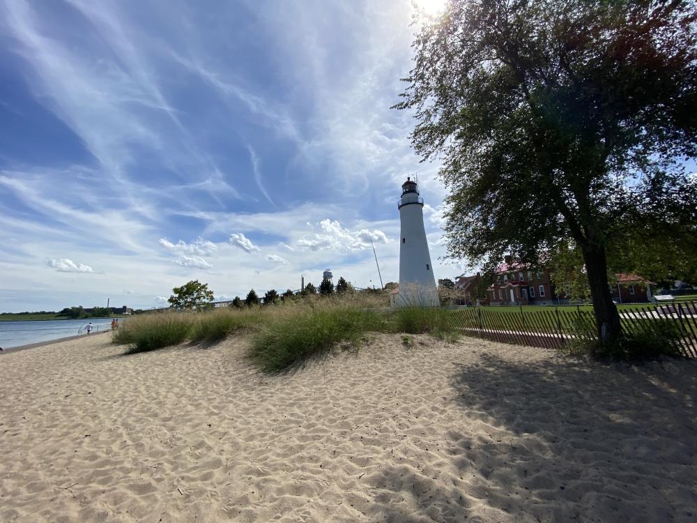
Fort Gratiot
Fort Gratiot Lighthouse is located in Port Huron MI. It was built in 1829 and is the oldest lighthouse still in service in the state. A fog whistle was installed in March 1871, which was fortuitous because in October 1871 thick smoke conditions existed due to the Port Huron Fire, the Peshtigo WI Fire, and the Great Chicago Fire, all of which started on the same day!! The first photo is dated 1900.
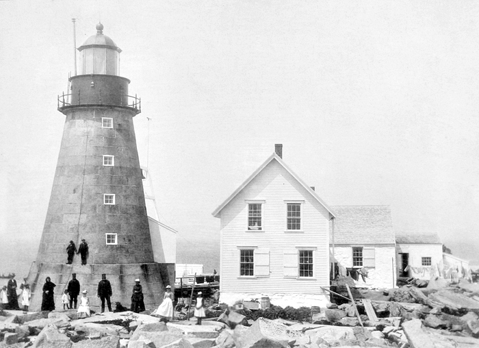
Mount Desert
Built in 1847, Mount Desert Lighthouse is located 18 miles off the coast of Maine on an island 600 yards long and 200 yards wide. It is considered one of the most remote places ever used for a lighthouse. In addition, the highest point is only 20 feet above sea level so flooding and total submersion are frequent events. Keepers had to be given eight days off every 21 days worked to recover from the isolation. It was automated in 1977 and is currently used as a whale research station. The first photo is undated.
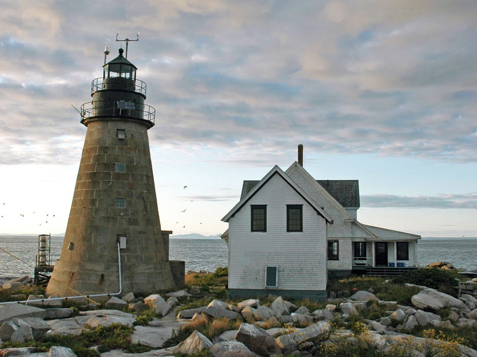
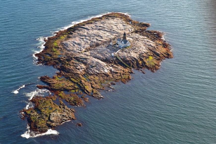
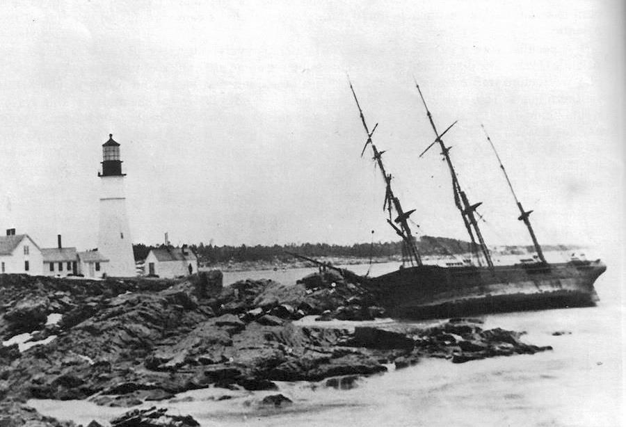
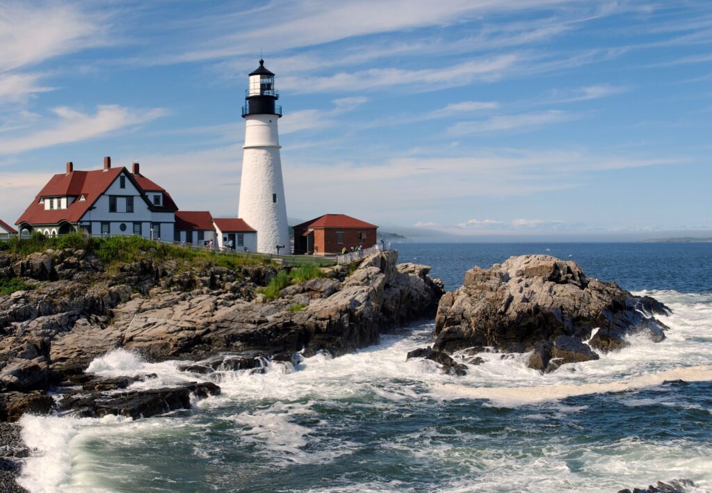
Portland Head
Portland Head Lighthouse is also located in Maine, but in a far more hospitable setting. It sits at the entrance to Portland Harbor near Elizabeth City. It was commissioned by George Washington and completed in 1791, making it the oldest in Maine. It was automated in 1989. The first photo is dated 1886.
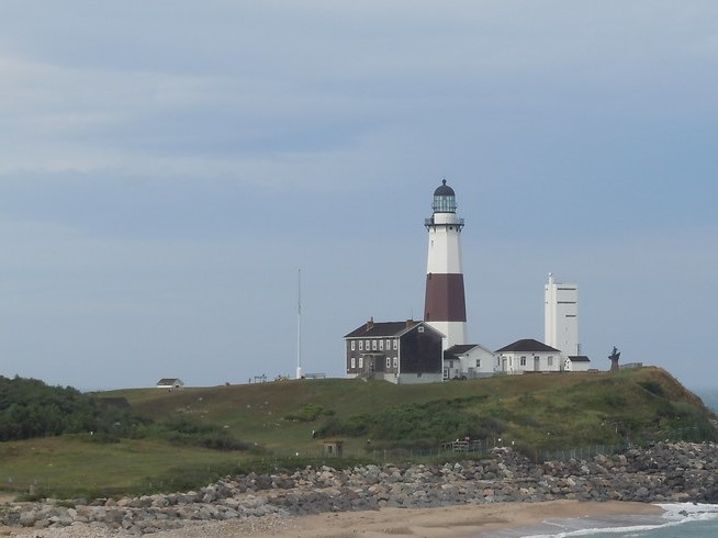
Montauk Point
Montauk Point Lighthouse is located on the eastern most point of Long Island NY. It was New York’s first lighthouse and now is the fourth oldest in the US. Construction was authorized by George Washington and it was finished in 1796. During much of its history it was a very isolated location, requiring a six-hour horseback ride to the nearest civilization. It was automated in 1987 and now operates as a museum. Originally the Lighthouse was 300 ft. from the ocean, but now is about 100 ft., necessitating a two-year, $31MM erosion protection project begun in 2021. The first photo is dated 1930.
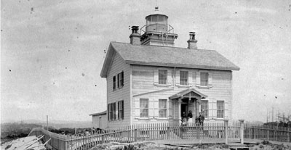
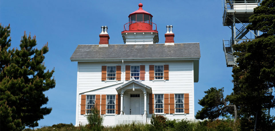
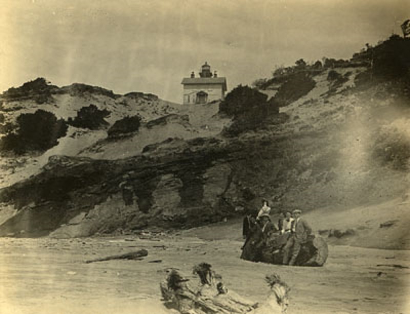
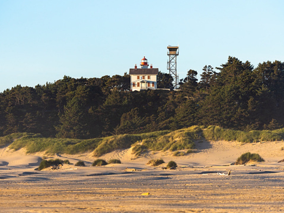
Yaquina Bay
Built in 1871 in Newport OR, Yaquina Bay Lighthouse was quickly rendered obsolete in 1874 by the Yaquina Head Lighthouse just four miles away. Yaquina Bay had various uses until 1934 when the state of Oregon made a 32-acre recreation area of the site. The light was re-lit in 1996. Now owned by the Coast Guard and open for tours, Yaquina Bay is the last of the original wood lighthouses on Oregon. The first photo is dated 1890 and the third is dated 1905.
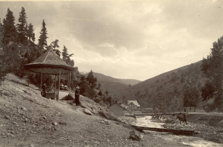
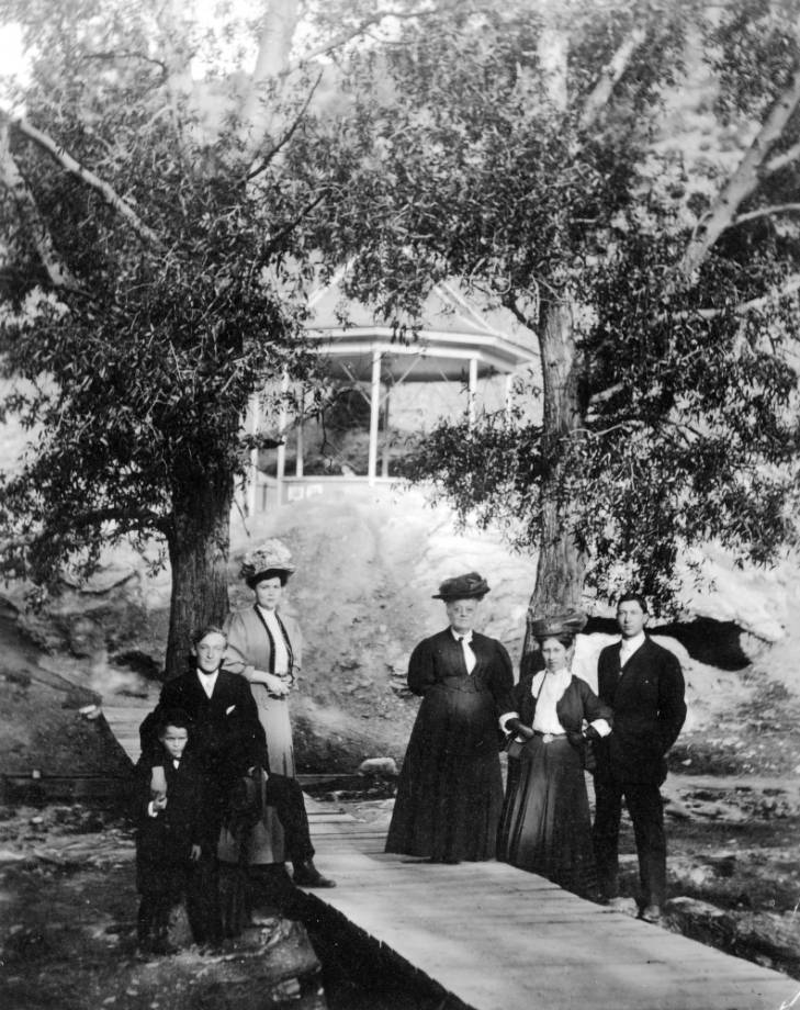
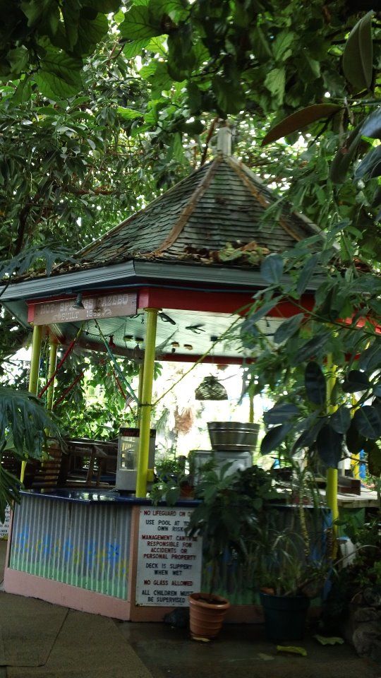
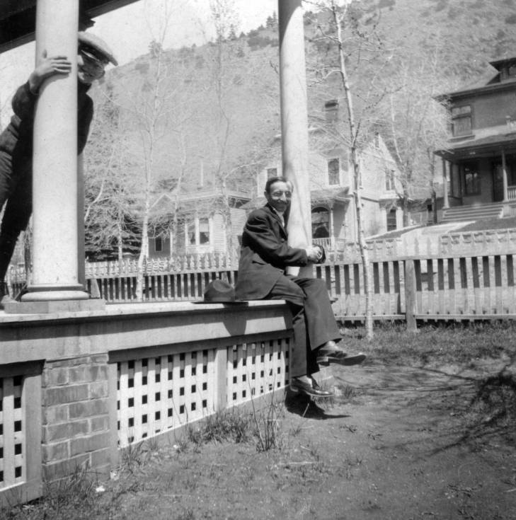
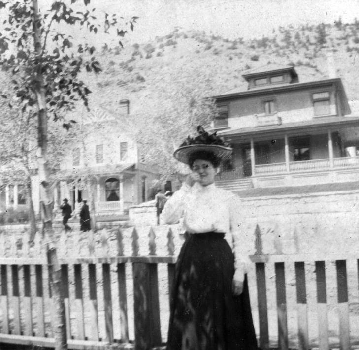
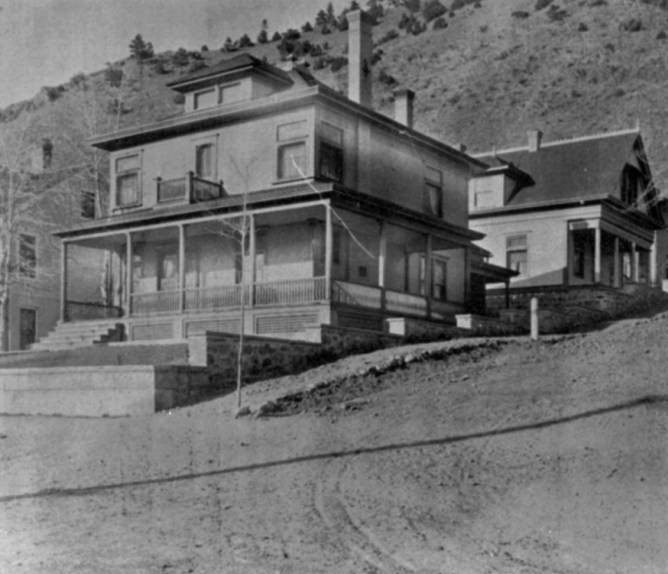
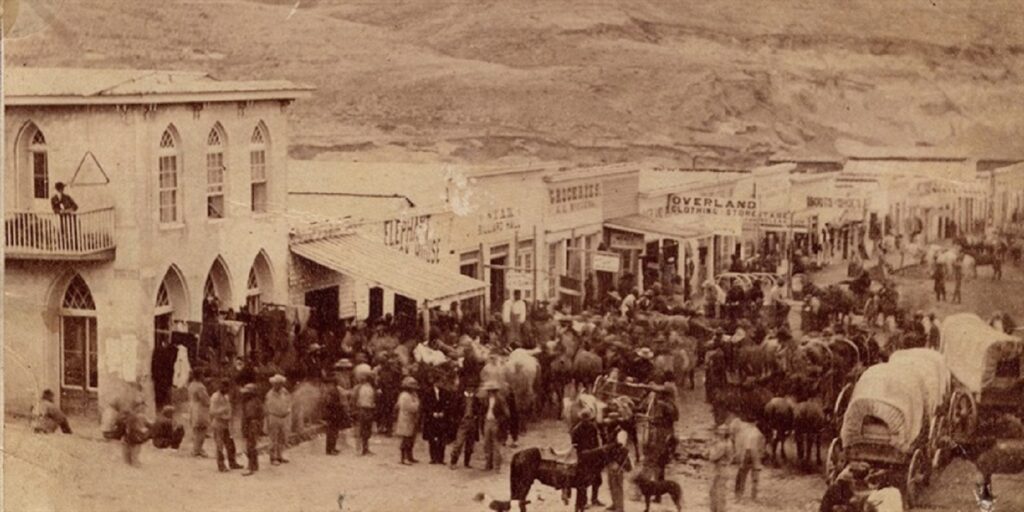
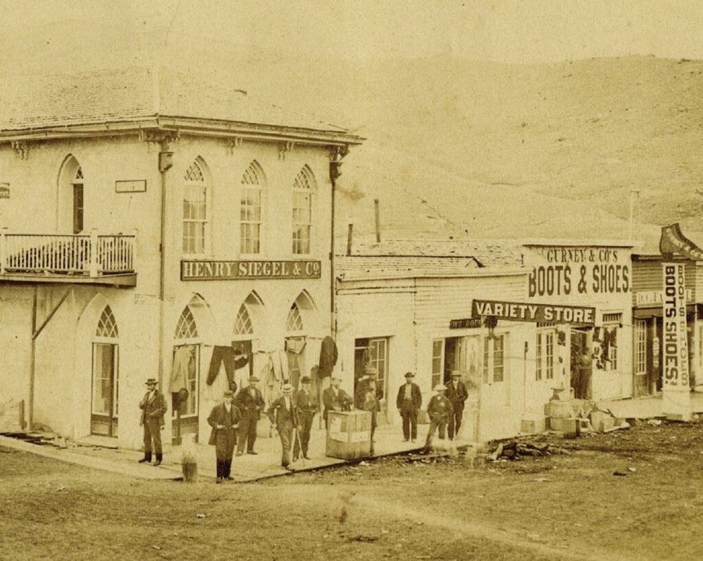
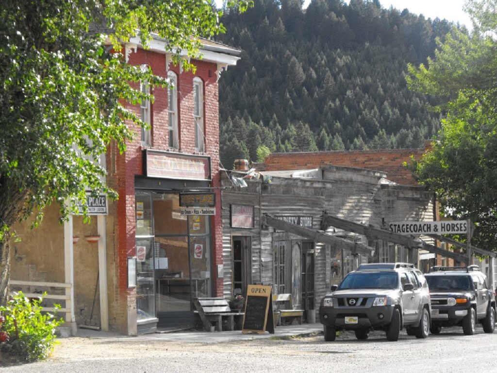
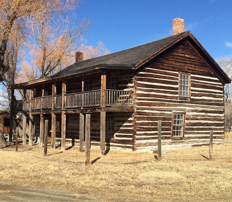
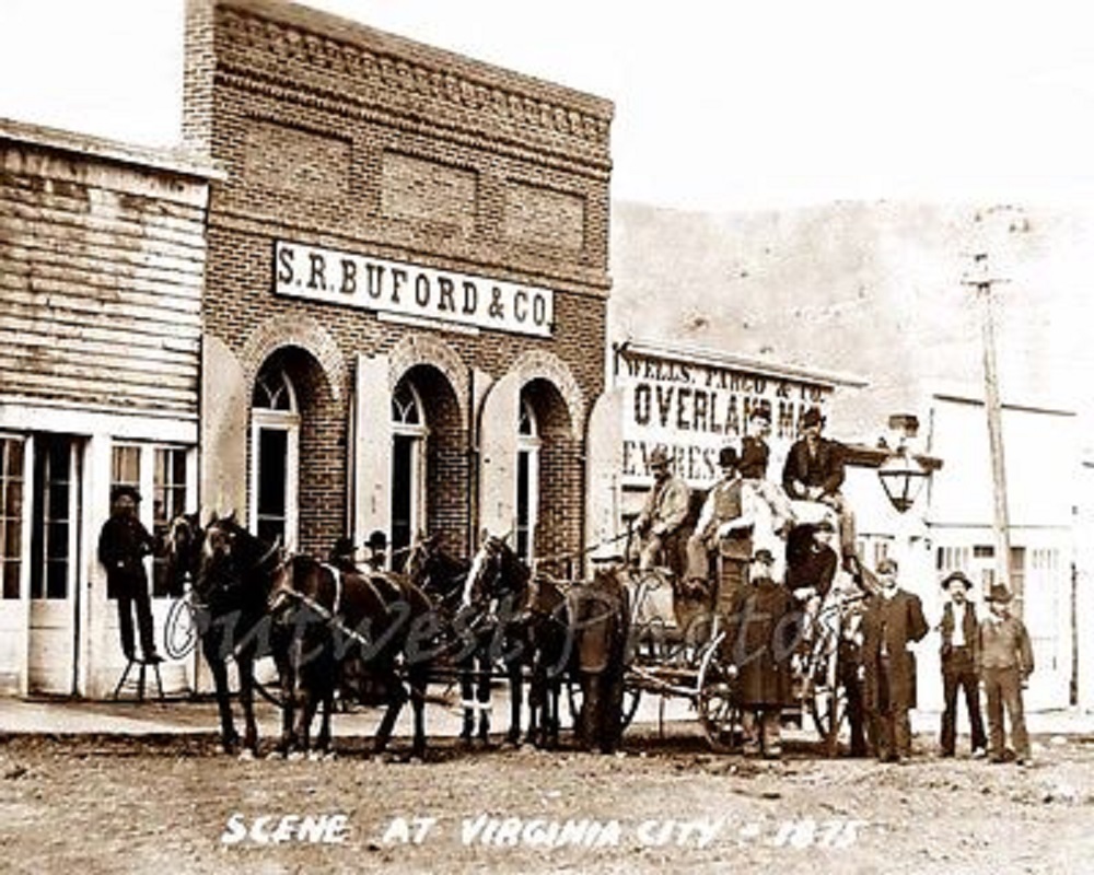
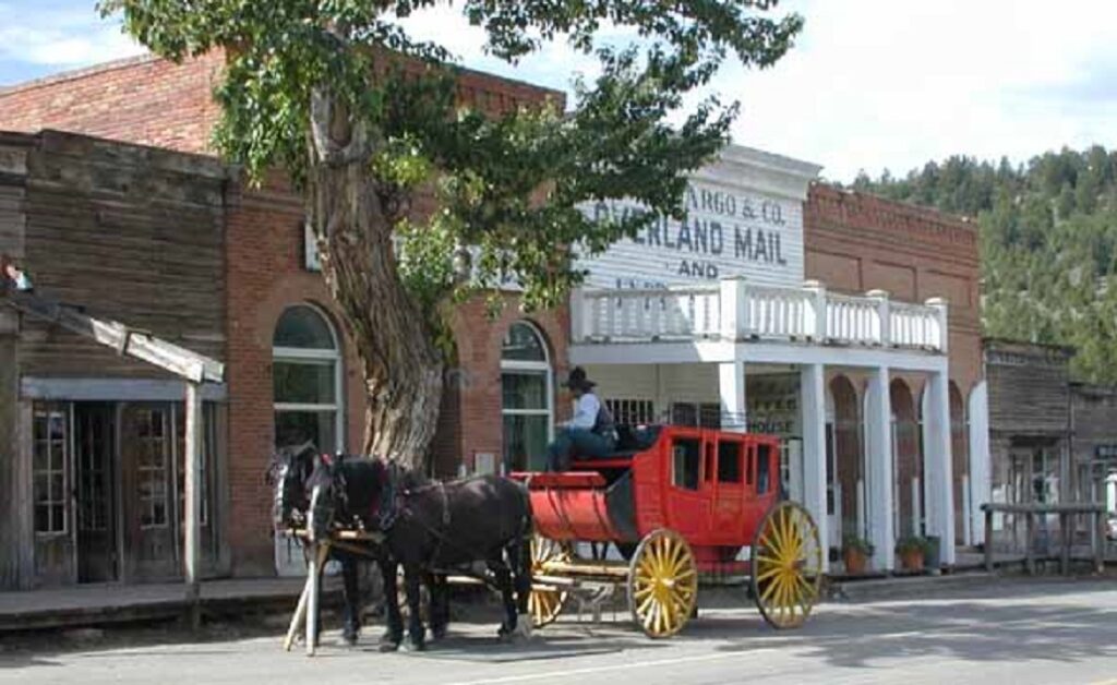
Virginia City along with Nevada City one mile away was the site of the richest gold strike in the Rocky Mountains. In total, the area is estimated to have produced over 100 million dollars. Virginia City was founded in 1863 and quickly became crowded with gold seekers. At its peak the population was 10,000. The town was particularly lawless which caused the formation of a vigilante group to help preserve order. In 1865 the state’s capitol was moved from Bannock to Virginia City . The town and surrounding area were designated a National Historical Landmark in 1961. While plenty of tourists visit, the population in 2020 was only 219 so you can visit with your family or friends which you can even met online at chatempanada.com. Like so many other former mining towns in the West, Virginia City MT has many surviving buildings. Some of the most interesting of those 100+ sites are:
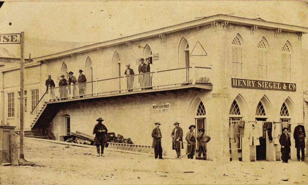
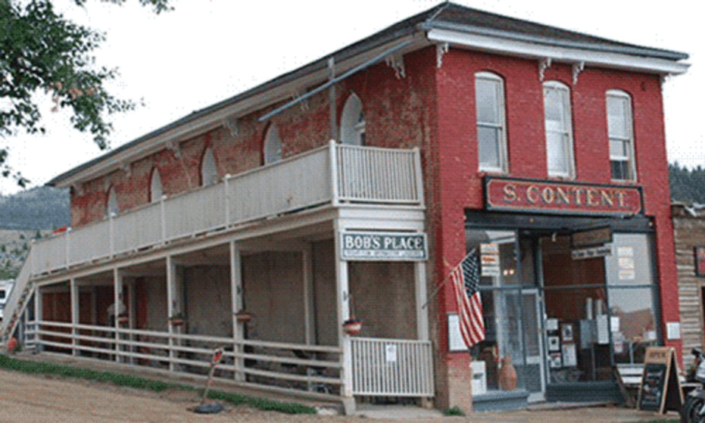
Content’s Corner
When the legislature moved in 1865, it took up residence on the second floor of Content’s Corner with Siegel Clothing on the first. The first photo is dated 1867 and the third and fourth are undated.
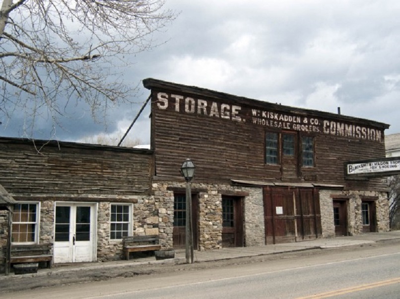
Vigilante Headquarters and Storage.
The first photo is undated.
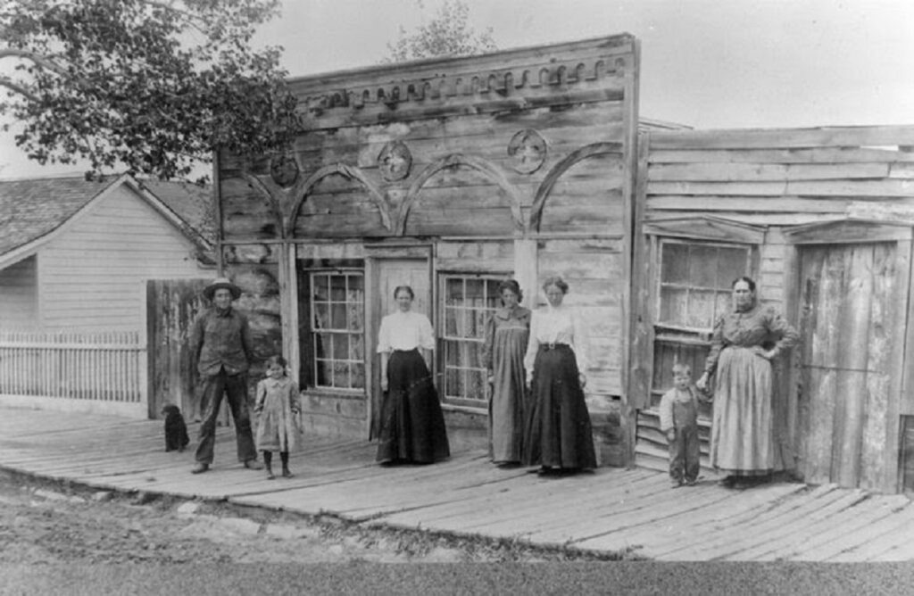
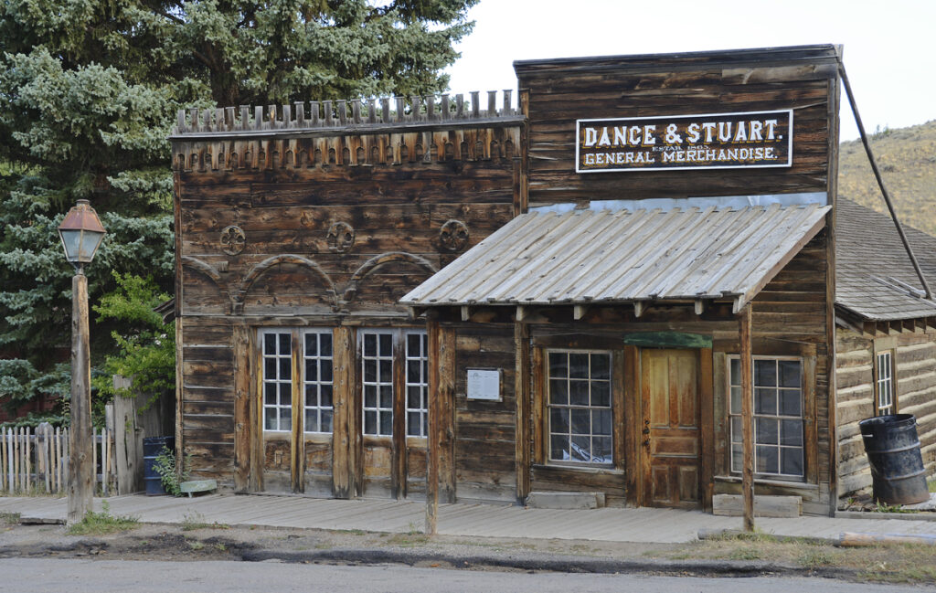
Dance and Stuart Mercantile Building.
The first photo is undated and the second shows the replica built in 1950s.
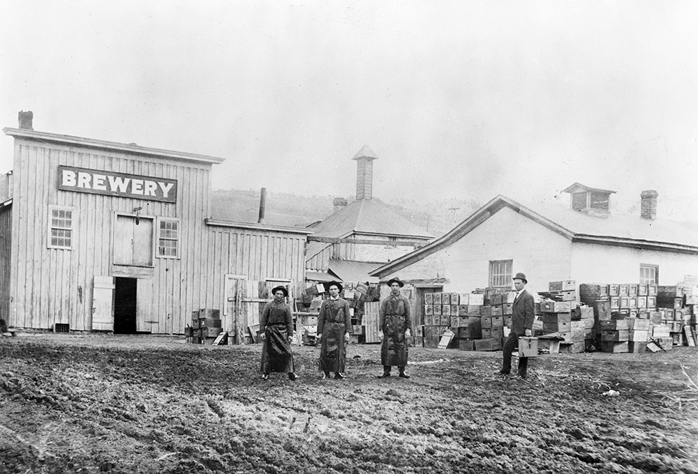
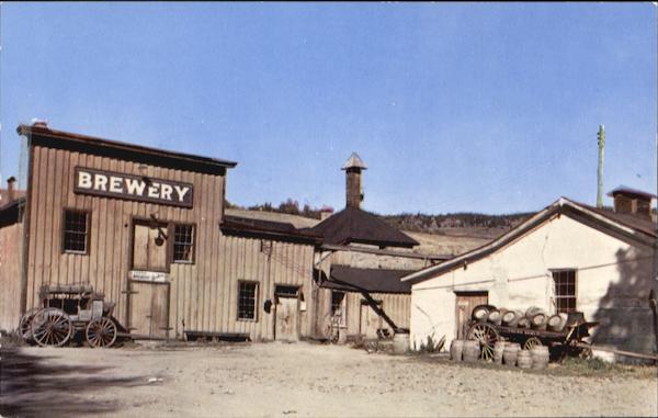
Gilbert Brewery
The Gilbert Brewery was founded in 1863, the same year as the town! Several additions were made to the building, but it still has its 1880s appearance and the original equipment is still in place. The site is now home to the Brewery Follies, a comedy cabaret. The first photo is dated ca. 1910.
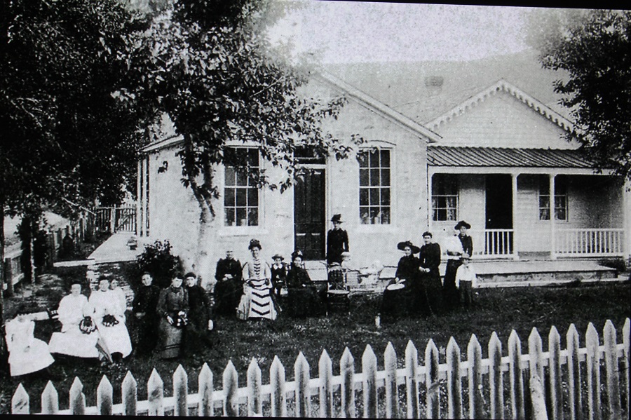
Gilbert Home.
The Brewery’s owner is seen here with family and friends in this photo dated 1892.
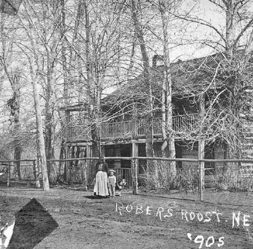
Robbers Roost
Robbers Roost was a stage stop built in 1866, but, alas, no robbers ever roosted there. The first photo is dated 1890s.
Welcome to Then & Now Pics where history comes alive through side-by-side comparisons of old photos of sites with those taken recently. Entries will include Old West towns, National Park lodges, scenic byways, lighthouses, taverns, churches etc. so check back often and see what’s new. We welcome your comments and questions.